World Wide Fund for Nature/ World Wildlife Fund (WWF)
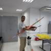
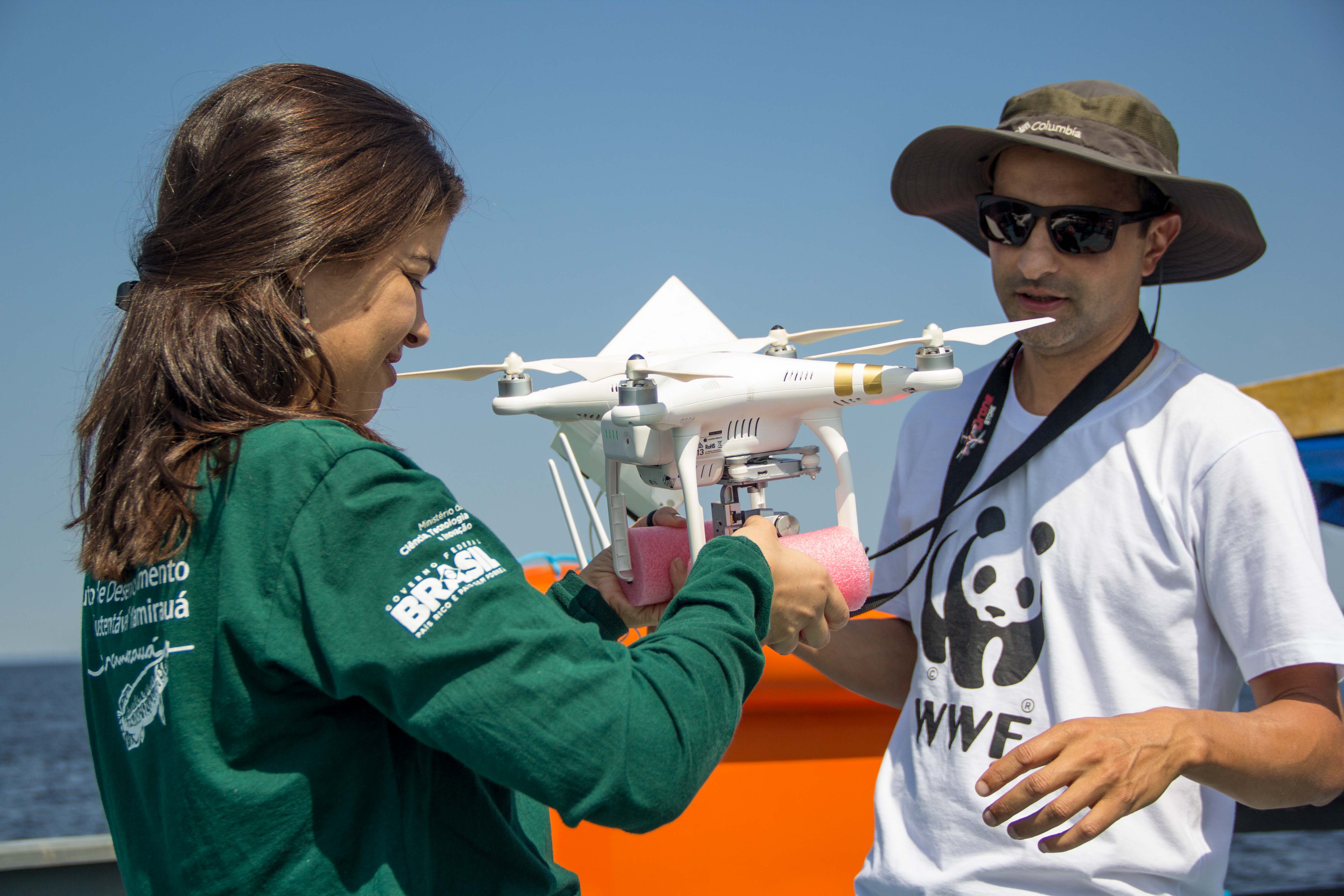
Monitoring river dolphins in the Amazon is expensive and time consuming. Because of that there is a scarce understanding about their abundance and distribution. Our study aimed at evaluating the effectiveness of UAV to optimize data collection in population studies of river dolphins. We tested the potential for detection and accuracy of dolphin images captured using a drone in real conditions. Two quadcopter drones (DJI Phantom 3 and 4) were launched from a double-decker riverboat navigating at 10 km/h, in an average distance of 50 m parallel to the river margin. 80 km of transects were sampled by drones, totalling eight hours of videos recorded. River dolphins were clearly detected in a range of 100m from the drone, being possible to distinguish animals from the two species. However, strong winds made it hard to land the drones. Preliminary results have shown this technology has great potential to support population studies on river dolphins. However, this method requires improvements on the range of detection, flight duration, and development of an algorithm to provide animals automated detection. Insight are welcome!
15 February 2017 9:56am
Hey Marcello,
Thanks for sharing your project! i was wondering if you might be able to give a bit more information about the challenges you're looking for feedback on. From your post, it sounds like you are asking for two things:
- Practical suggestions or recommendations of how to improve flight time, which could include suggestions for different drone models or improvements
- Help developing an algorithm to detect animals automatically
Is that right?
On the second point, I wonder if you have seen the project @nksheridan has been working on in our Human-Wildlife Conflict group: an automated elephant-detection system. The aim of the system is to acquire images when PIR is triggered (like a camera-trap) and use machine-vision algorithms to determine if these images contain elephants - sounds pretty similar to what you are looking to do with dolphins?
I also wonder if you might be interesting in adding your experience to the best-practice guideline document for using drones that's being compiled by some of our members? Find out more here:
I've also attached to my comment a couple of links with more information about your project that I've seen you share in other places. The first one leads to good write up of your project and the second to a video that includes some great foootage of river dolphins captured with your drones.
(Attached Image credit: © Amanda Lélis)
Cheers,
Steph


24 February 2017 8:46am
Hi Marcelo,
If you are flying a phantom you should be able to just grab it to land. hover it near an assistant (who doesn't have long hair flying around ;) and they grab the metal feet, even with one hand. They hold it very steady and you then land manually/shut off the propellers by holding the altitude throttle down. Take a couple practices first but this is how we land on rubber boats and stuff.
if you want larger range you will need a fixed wing drone (like an eBee) which is more expensive, and will require approval from civil aviation, especially you are flying out of visible range, to ensure you are not in conflict with any other aircraft (military helicopters, other drones etc..).
best,
aurélie

24 February 2017 11:53pm
Hi,
I'd like to point out first that I do not know the drone laws where you are working, so some of what I suggest may not be possible, but based on my experience flying UAVs, I have some suggestions:
1) have you considered a fixed wing aircraft? Something like the Skywalker EVE (https://hobbyking.com/en_us/eve-2000-pnp-white.html/?___store=en_us) is able to stay airborne for up to 4 hours at a time, in which time you'd be able to cover about half of your study area. It can be fitted out with a flight controller to fly auto missions, and has 2 motors, so good redundancy. They also deal better with wind, and the air can be smoother higher up
2) Are you running photo or video? Running the research like a photogrammetry mission, you could map the river and collect georeferenced images of the whole river. Flying at 80 m with a good camera, you can get a resolution of under 2cm/pixel on the ground. Would this resolution work? Do you need to be able to stop and hover over them?
3) using a fixed wing (and depending on the laws) you could launch from the land and follow the UAV in the boat as it maps the river following an autonomous mission. Once it's done it's several hours of flying, you could return to dry land to set it down.
i understand that fixed wing aircraft are harder to fly, and you can't just buy what you'd need "off the shelf", but you cold reach out to a company (like where I work) to build it for you, or even cheaper, build it yourself if you have some time for trial and error.
if you wanted to stick with the phantom, have a look into stuff like this for landing:
http://www.dronerafts.com/
or waterproof drones
http://www.swellpro.com/waterproof-drone/splash-drone-auto.html
https://www.quadh2o.com/hexh2o/hexh2o-kit/
9 March 2017 9:39am
Hi Marcelo,
Really interesting project you're working on! Looks like it's all going well. You mentioned "this method requires improvements on the range of detection, flight duration, and development of an algorithm to provide animals automated detection." so I'd like to go through these in turn.
1. Range of detection
You've probably thought of this stuff already but just in case:
Initially I thought it would be better to use photos rather than video but after seeing the video on your facebook feed it looks like it does add a lot of value. Photos would have a higher resolution than video and you'd therefore increase your ground resolution. What I'd suggest is a mix between the two - you could take photos at a relatively high frequency with high % overlap. For some Canon cameras you could use CHDK to automate this: http://chdk.wikia.com/wiki/FAQ
The other way to increase ground resolution is to use a higher focal length lens (ie 'zoom' in). Most of the small cameras used on drones have a wide view, you could swap the lens out if possible.
2. Flight duration
This is the topic I'm most familiar with. For increasing flight duration it either takes investment of more money or more time. You can buy a multirotor that flies for longer for more money or you can build one, and that takes more time. If you're flying from a boat then I'd rule out planes. Be aware that you'll be able to get a range of 100km from a plane without too much hassle and even 200km isn't impossible. With an Ardupilot (http://ardupilot.org/) flight controller you can automate the flights through a set of waypoints for either multirotors or planes.
For a long duration multirotor you can realistically expect a flight time of circa 45 minutes to 1 hour. There's a good thread on long duration quads here: https://www.rcgroups.com/forums/showthread.php?2832410-Long-flight-time-quadcopter-build-research-questions It involves both bought and built options. RCGroups is a good resource for these sort of questions. The key criteria to consider are high efficiency motor/prop combinations, lightness of all components and the energy density of the battery.
Alternatively, if you're only interested in flight duration and not the range increase that comes with this then you could simply purchase additional batteries.
We recently wrote a blog post to help people choose a quad that might be of interest to you as we focused on flight duration: http://projecterebus.weebly.com/blog/lets-revisit-quadcopters
3. Algorithm for automated animal detection
This is the area I know least about, however, we've been in touch with a couple of people that might be able to help. Firstly, Britta Ricker https://geography.washington.edu/people/britta-ricker. Britta mentioned that she is interested in post-processing of images collected from drones. Secondly, Lian Pin Koh http://www.adelaide.edu.au/directory/lianpin.koh, of Conservation Drones, I'd bet he or his contacts are working on this.
Have you thought about contacting a tech company like Google or Facebook? They're definitely working on machine learning that involves recognition in photos so might be willing to collaborate if you can provide them with a large data set?
Good luck with the project! Hope all goes well. Let me know if there's any questions on the above.
Cheers, Tom M
Stephanie O'Donnell
WILDLABS