Data Logger Suggestions

31 January 2024 1:42pm
13 February 2024 4:29pm
Thank you for the help!
Funded PhD Opportunity: Moose Acoustics at the University of New Hampshire

13 February 2024 1:21pm
Mass Detection of Wildlife Snares Using Airborne Synthetic Radar
7 January 2024 6:50am
10 February 2024 1:32pm
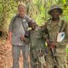
Operating at 2GHz the radar penetrates vegetation so could see through canopy, but not through trunks of trees. However snares are typically set in groups, so one could maximise chance of locating all snares by carrying out a circular/spiral flight path after detection of a potential snare to locate others

12 February 2024 12:12pm
Hi David,
I assume this will only work with wire (metal) snares? We often see snares made of nylon rope (used for lucern bales) in the field, which I assume will be missed by the radar?
Cheers,
Chavoux
13 February 2024 8:43am
Hi David, would love to collaborate with you on this topic. A few years ago Dr. Nick van Doormaal did his PhD on snaring with us and we ran a number of experiments on the detection of snares in a real world scenario using trained anti-poaching teams. I think it would be quite simple to replicate the study and then look at the efficacy of remote sensing vs human detection. Let me know if you are interested in chatting further!
Computer Vision for Ecology Workshop 2025 Call for Applications

12 February 2024 9:29pm
Early career mammalogist funding Opportunity
12 February 2024 8:57pm
Seeking doctoral student to Join Move.inFormation research group for Andean condor biologging

12 February 2024 8:01pm
eDNA Collaborative: Small Grants Application for Marine eDNA Research
12 February 2024 7:45pm
The eDNA Collaborative is partnering with Experiment to offer $80,000 in small grants to support projects that demonstrate novel approaches in marine eDNA collection, analysis, or application.
Submission Deadline: March 30, 2024
ChatGPT for conservation

16 January 2023 10:04am
4 February 2024 9:28am
The greatest issue with ChatGPT is GIGO (Garbage in, garbage out). It doesn't matter how good the machine learning algorithm is, if it gets fed bad information (data) it will regurgitate bad information. One obvious problem is that it does not reference its information sources. So some of it might be established beyond any doubt, but then it includes something it made up out of thin air with an equally authoritative tone. Because at bottom, ChatGPT is still a dumb machine (or collection of machines) that has to be told what to do by its programmers. It can be useful, but for conservation issues that can have far-reaching implications, I will not trust it. It could be really useful with the addition of two measures (maybe one has already been implemented?):
- The option to show the references for all sources (for each statement that it makes; and if it makes its own logical deduction, show that explicitly).
- Either weighing or restricting its input to sources that has been checked (e.g. peer-reviewed articles) for at least its scientific output (maybe/hopefully Google is already doing this).
I think with the addition of these two functions it will really become useful to conservation. But we are not there yet. In the meantime it is similar to Wikipedia, maybe a good a starting point for further research.

4 February 2024 5:39pm
Just so you know, I uploaded both a photo without a cat and one with a cat in the picture and ask if there was a cat in the picture it got it correct both times.
Uploading pictures to wildlabs doesn't seem to work at this time, so I can't show you the response, but the second answer with the cat in the picture it answered with:
"Yes, there is a cat in this picture. It appears to be in the middle of the driveway."

12 February 2024 1:05pm
You can already achieve both of them with your prompt.
Or, if you're not using ChatGPT specifically but another LLM that you can fine tune, you can use RAG or fine tuning to extra train the algorithm on the data you want it to extract information from.
With ChatGPT you can create your custom GPT now.
Wildlife Drones will be hosting in-person demos in the U.S.

12 February 2024 3:32am
Seeking advice for remotely retrieving high frequency acceleration data

28 January 2024 1:26am

28 January 2024 9:42am
Hi Maggie!
This sounds like a really interesting - and challenging project!
UHF is used for tranfer of acceleration data (along with other stuff like magnetometry and GNSS locations) by systems developed by companies like Milsar and TechnoSmart.
Ceres Wild uses satellite transfer over the GlobalStar but no raw acceleration data is transmitted.
I would fear the bandwidth would be too restrictive if you insist in using satellite based transfer of accelerometry.
Cheers,
Lars

29 January 2024 5:19pm
This sounds like a lot of fun!
The lowest cost satellite comm I know of is https://swarm.space/. It's pretty cool tech, but the data rates are quite low.
Do you have any idea how much data you need to move per day on average?
Perhaps LoRa would be an option? Here is an example of a LoRa device https://www.adafruit.com/product/4284
LoRa is not satellite, but it has quite a long range which may suffice? It is also pretty low data rate, but it is a good deal better than Swarm. The best thing about LoRa is that the end-point can be very low power, so battery life can be quite good.
If you know somewhere the crocs frequent, you might also be able to work something out with Bluetooth LE? Both LoRa and Bluetooth would require the installation of at least one base station. Lora's base station could be substantially further way.
11 February 2024 2:33am
I have a few suggestions Maggie. Hopefully one or more will be useful.
Preprocessing - Compressing the data before transmission will reduce file size and reduce transmission time.
Reduce data volume - I guess the animals are only active for some periods and a lot of the time are just "cruising along". So a useful strategy could be to only start recording when a certain threshold of acceleration occurs. And if you also buffer the data for say 10 seconds, you will get info about what's leading up to the activity. And adding a GPS module you will get some info on where the activity occurred plus movements prior. This will of course increase the data volume but only recording the most recent location will probably suffice as the location of the previous activity will tell you how far the animal moved.
Use LoRa instead of satellite - LoRa is well suited to this type of application. I saw in
that the home range of crocodiles is relatively small so although a forested area will limit LoRa performance, the range should be sufficient. You could also use multiple base stations if needed.
Of course eventually the data that has been recorded at the LoRa base station(s) will need to be collected. You could add a long range radio to the base station, or just collect the data 'manually'.
Hope this helps
PhD position: Foraging in the landscape of peril

10 February 2024 7:27am
Post-doc possition - Field spanning movement ecology, ecology of fear, bio-logging science, behavioral ecology, and ecological statistics
10 February 2024 7:20am
Funding for Camera Trap Projects
24 January 2024 5:23pm
9 February 2024 6:42pm
I'm in Paraguay!
I'm looking for any starting points - databases, specific orgs i can apply to etc.
I have found a nonprofit I've been working with and have found several grants to apply through my partnership with them but am obviously looking for more.
9 February 2024 6:42pm
I'm in Paraguay!
I'm looking for any starting points - databases, specific orgs i can apply to etc.
I have found a nonprofit I've been working with and have found several grants to apply through my partnership with them but am obviously looking for more.
9 February 2024 6:45pm
This is a great starting point - thanks for the help
eDNA Innovation Grants

9 February 2024 4:26pm
Bio-Logging Science Symposium

9 February 2024 3:59pm
WILDLABS Awards 2024: Meet the judges

9 February 2024 9:52am
Conservation Technology Intern - The Wildlife Restoration Foundation
8 February 2024 7:52pm
Improving camera traps for monitoring mustelids
8 February 2024 7:35pm
Camera traps often monitor larger animals, so passive infrared sensor tends to miss small and fast species like mustelids. Researchers tested the Mostela against a tree-mounted camera trap to compare performance and make recommendations for future development and testing.
ISPA: A New System for Transcribing Animal Sounds
8 February 2024 7:17pm
These researchers are introduce the ISPA (Inter-Species Phonetic Alphabet) as a new way to precisely interpret and transcribe animal sounds. By using text to represent sounds, existing human language machine learning models could be used more successfully in field research.
Apply Now: UW Data Science for Social Good Projects

8 February 2024 6:45pm
Sign up for Data Science for Social Good 2024! This summer program is a great opportunity to get dedicated data science support on a conservation (tech) project or to get rich experience as a student in the field. More info in the link - student apps due 2/12, projects due 2/20.
PhD Opportunity - Exploring plants’ sensing capability with vibroacoustics

8 February 2024 5:35pm
Account Manager - Conservation & Nonprofit
8 February 2024 4:30pm
Fast-track NbS investments with in-house due diligence

7 February 2024 3:42pm
Rapid onsite DNA test identifies bushmeat at airport

6 February 2024 3:47pm
World Wildlife Day 2024 UN Celebration & Networking Event
6 February 2024 2:37pm

6 February 2024 9:08pm
Southern African Wildlife Management Association Conference 2024

6 February 2024 12:20pm
Conservation Technology for Human-Wildlife Conflict in Non-Protected Areas: Advice on Generating Evidence

22 January 2024 11:36pm
23 January 2024 1:54pm
This is an area where my system would do very well in:
Also, as you mention areas dominated by humans, there is a high likelyhood that there will be enough power there to support this system, which provides very high performance and flexibility but it comes with a power and somewhat a cost cost.
Additionally, it's life blood comes with generating alerts and making security and evidence gathering practical and manageable, with it's flexible state management system.
Ping me offline if you would like to have a look at the system.
4 February 2024 8:16am
Hi Amit,
The most important thing is that the livestock owners contact you as soon as possible after finding the carcass. We commonly do two things if they contact us on the same day or just after the livestock was killed:
- Use CyberTracker (or similar software) on an Android smart phone to record all tracks, bite marks, feeding pattern and any other relevant signs of the reason for the loss with pictures and GPS coordinates. [BTW, Compensation is a big issue -- What do you do if the livestock was stolen? What do you do if a domestic animal killed the livestock? What if it died from disease or natural causes and was scavenged upon by carnivores afterwards?]
- In the case of most cats, they would hide the prey (or just mark it by covering it with grass or branches and urinating in the area). In this case you can put up a camera trap on the carcass to capture the animal when it returns to its kill (Reconyx is good if you can afford it - we use mostly Cuddeback with white flash). This will normally only work if the carcass is fresh (so other predators would not be able to smell it and not know where it is yet), so the camera only has to be up for 3-5 days max.
This is not really high-tech, but can be very useful to not only establish which predator was responsible (or if a predator was responsible), but also to record all the evidence for that.
AI volunteer work
3 February 2024 12:29pm
Passionate engineer offering funding and tech solutions pro-bono.

23 January 2024 12:06pm

26 January 2024 3:18pm
Hi Krasi! Greetings from Brazil!
That's a cool journey you've started! Congratulations. And I felt like theSearchLife resonates with the work I'm involved round here. In a nutshell, I live at the heart of the largest remaining of Atlantic forest in the planet - one of the most biodiverse biomes that exist. The subregion where I live is named after and bathed by the "Rio Sagrado" (Sacred River), a magnificent water body with a very rich cultural significance to the region (it has served as a safe zone for fleeing slaves). Well, the river and the entire bioregion is currently under the threat of a truly devastating railroad project which, to say the least is planned to cut through over 100 water springs!
In face of that the local community (myself included) has been mobilizing to raise awareness of the issue and hopefully stop this madness (fueled by strong international forces). One of the ways we've been fighting this is through the seeking of the recognition of the sacred river as an entity of legal rights, who can manifest itself in court, against such threats. And to illustrate what this would look like, I've been developing this AI (LLM) powered avatar for the river, which could maybe serve as its human-relatable voice. An existing prototype of such avatar is available here. It has been fine-tuned with over 20 scientific papers on the Sacred River watershed.
And right now myself and other are mobilizing to manifest the conditions/resources to develop a next version of the avatar, which would include remote sensing capacities so the avatar is directly connected to the river and can possibly write full scientific reports on its physical properties (i.e. water quality) and the surrounding biodiversity. In fact, myself and 3 other members of the WildLabs community have just applied to the WildLabs Grant program in order to accomplish that. Hopefully the results are positive.
Finally, it's worth mentioning that our mobilization around providing an expression medium for the river has been multimodal, including the creation of a shortfilm based on theatrical mobilizations we did during a fest dedicated to the river and its surrounding more-than-human communities. You can check that out here:
Let's chat if any of that catches your interest!
Cheers!
2 February 2024 1:22pm
Hi Danilo. you seem very passionate about this initiative which is a good start.
It is an interesting coincidence that I am starting another project for the coral reefs in the Philipines which also requires water analytics so I can probably work on both projects at the same time.
Let's that have a call and discuss, will send you a pm with my contact details
There is a tech glitch and I don't get email notifications from here.

10 February 2024 2:19am
Hi Andrea,
The OpenLog Artemis might be an option. I haven't used one of these yet, but its what I immediately thought of. Built in real time clock and IMU that records to microSD. It has four 14-bit ADCs and I2C connectors for the 'Qwiic' or 'grove' sensor boards. I'm not sure if it has programmable on/off cycles with the clock but you may find an existing project that does this.