
Mark Wallace
Few things are more important to polar bears than ice, which provides the Arctic carnivores with food, migration routes, and places to bear their young. But over the last four decades, there has been less and less Arctic sea ice available, and the summer period of ice melt has grown longer, making survival more difficult for animals who currently number only about 25,000 around the world.
To track the impact of changes to the Arctic ice, San Diego Zoo Global, the wildlife conservation group that operates the San Diego Zoo and Safari Park, is working with aerospace contractor Northrop Grumman Corp. to develop an autonomous hexacopter drone that will monitor ice formation and polar bear behavior at a level of detail that’s never been available before. This November, the group will bring the drone — largely hacked together from modified off-the-shelf products in Northrop’s internal makers’ space, the FabLab — to the edge of the Arctic Circle to study ice and bears for 10 days in temperatures as low as 30 degrees below zero Fahrenheit. The technology will map sea ice and monitor wildlife at a scale not previously possible, in an environment that would break most high-resolution monitoring equipment, but which is crucial to the survival of Arctic polar bear populations.
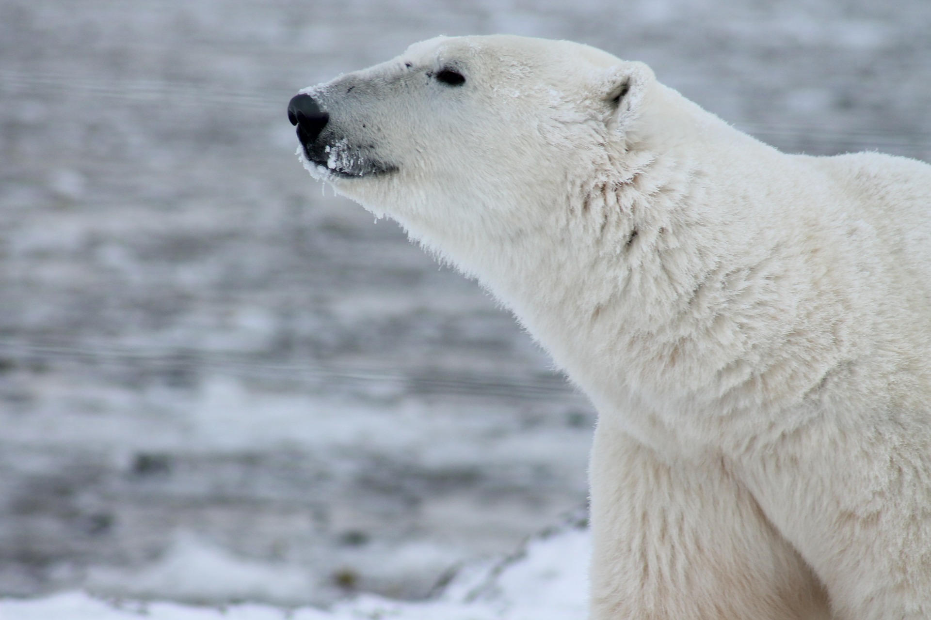
“There’s a very real issue of habitat loss,” says Nicholas Pilfold, a population sustainability scientist at San Diego Zoo Global, who will be part of the expedition. “We’ve lost 40% of summer sea ice coverage since satellite records began. The less sea ice that’s available for the polar bears, the worse they do, the worse their survival, the worse their reproduction, the worse their body condition.”
Arctic polar bears are also being forced to spend a larger portion of each year on land, a period in which they largely fast. Historically, the melting summer ice pack has forced polar bears onto land in late July or early August, Pilfold says. They venture back onto the ice as it forms in mid-November. But some recent years have shortened that period by as much as a month, with bears remaining on land from June to December.
“One of things we’re interested in is the behavior of the polar bears as the season gets later and later, and they’ve been off the ice fasting for the entire summer,” says Megan Owen, director of population sustainability at San Diego Zoo Global. “How does their behavior and their willingness to take risks in going out on the ice change as the sea ice starts to freeze up later and later?”
Charlie Welch [Photo: courtesy Northrop Grumman Corp.]
A Challenge Of Integration
While a similar program last year gave the Zoo and Northrop a chance to understand the environment in which the equipment would need to operate, this year’s expedition—to the Knife Delta region some 40 kilometers north of the town of Churchill on the Hudson Bay—will be the first time the new unmanned aerial vehicle (UAV) and its integrated sensor suite will be used to more comprehensively map and understand local sea ice formation and polar bear behavior. “What we’ve done this year is not just a really advanced wildlife UAV,” says Charlie Welch, an advanced R&D engineer at Northrop Grumman who provided the initial spark for the project in 2015. “We’ve built one of the most advanced small UAVs in the world right now.”
The project utilizes a DJI Matrice 600 Pro hexacopter, outfitted with a “sensor pod” containing an extremely high-resolution DSLR camera (the 50-plus megapixel Canon Eos 5DS), a five-band multispectral sensor generally marketed for crop monitoring (the MicaSense RedEdge), and a radar for measuring ice thickness developed by Aerotenna, a startup headquartered at the University of Kansas that has assisted NASA in its IceBridge mission to survey the Arctic and Antarctic ice sheets. Other commercial off-the-shelf technology such as low-cost radar altimeters and other components are also part of the package Northrop has assembled.
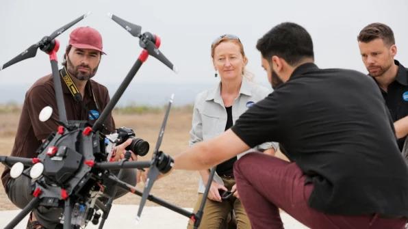
San Diego Zoo Global’s science team (L-R, facing camera: Dr. James Sheppard, Dr. Megan Owen, and Dr. Nicholas Pilfold) works with the Northrop Grumman technical team in the field to refine the sensor suite for their Arctic conservation efforts. [Photo: courtesy Northrop Grumman Corp.]
While the technology was readily available, the real challenge came in integrating the disparate sensors and making them work at the level of resolution the Zoo required. “It is a tremendous difficulty to take a bunch of cameras that don’t necessarily want to talk to each other and get them all to integrate extremely seamlessly,” Welch says, “and to be able to log all their information at almost an order of magnitude higher than they’re built to, to get the really accurate, cohesive data that the Zoo can use.”
The 50 megapixel camera lets the Habitat Monitoring System, as it’s known at the FabLab, achieve sub-centimeter-per-pixel resolutions, and a Raspberry Pi computer helps coordinate and control the various onboard devices. But much of the software that runs the sensors had to be upgraded by the team. “Normal GPS accuracy is around 1 to 2 meters,” Welch says. “We had to improve upon that, so now our GPS accuracy is about 1 to 4 centimeters, so that every photo taken in the air is geolocated almost an order of magnitude higher than is normally possible with systems like these.”
While the drone will pursue an autonomous flight path to cover a given area, the system will also run a pilot version of a machine-learning algorithm that will let it alert operators when a polar bear has been spotted, and, eventually, learn to track the bears as they travel around the ice, Northrop hopes.
The Change To Come
Despite what you may have heard about global warming, it remains mighty cold in the Arctic, so another crucial upgrade the Northrop team had to make was to ruggedize the sensor pod to enable it to operate in temperatures that can reach 30 degrees below zero Fahrenheit.
To provide insulation, the pod is surrounded by a casing of transparent Kapton film (often used to insulate space capsules), which remains stable at extremely low and high temperatures. (Think several hundred degrees below or above zero.) At around four thousandths of an inch thick, the film adds very little weight to the payload, which comes in at less than five pounds.
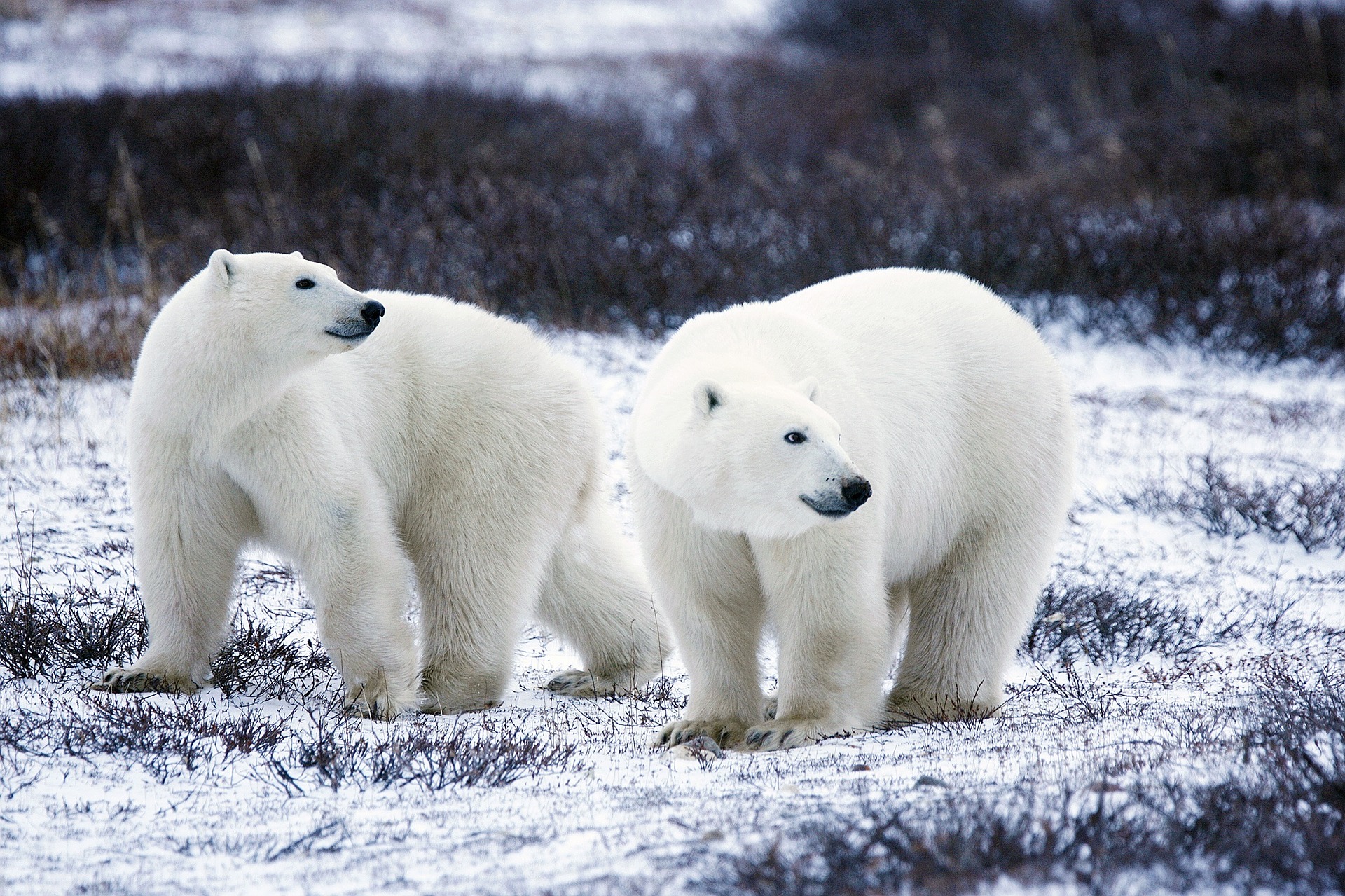
The small UAV presents the Zoo with an advantage that’s more than just technical. “As biologists, we’re always trying to improve the way we study animals, and look for minimally invasive approaches,” Pilfold says. “This is a much quieter machine than flying around in a helicopter, for example.”
While polar bear populations farther north are not suffering as much as those on the edge of the Arctic Circle, the Hudson Bay area the Zoo will study has the southernmost population of polar bears in the world. “These are the areas that are changing the quickest, so they’re the signal populations for us,” Pilfold says. “That’s why it’s important for us to focus on these areas right now, because really what we’re seeing is the early indication of the change to come, if climate change continues unabated.”
About the Author
Mark Wallace has written for the New York Times Magazine, Wired, Salon, and many others. He lives in San Francisco.
This article first appeared on fastcompany.com, and was republished here with permission.
Add the first post in this thread.