Group curators

Talia Speaker
- @TaliaSpeaker
- | She/her
WILDLABS
World Wide Fund for Nature/ World Wildlife Fund (WWF)

Lacey Hughey
- @lhughey
- | she/her
Smithsonian Conservation Biology Institute

Marianna Chimienti
Bangor University

Muhammad Rais
- @sahil
- | He/ His
Animal movement technologies have already significantly advanced our understanding of the natural world, from uncovering previously mysterious migration patterns and key movement corridors to demonstrating the impacts of anthropogenic pressures and climate change. Continuing advances in the development of technologies for collecting and transmitting bio-logging data, combined with the increased availability of high-resolution environmental data and analytical developments in movement modelling, are opening doors to novel applications. However, there are still major gaps in the space, including mobilizing movement data to translate data from tracking devices into insights for application in policy and practice. This group is a place for the animal movement community to connect and discuss our efforts to advance the field.
From 2025-2026, the Animal Movement group is run in collaboration with the International Bio-Logging Society.
Resources for beginners
Learn about WILDLABS Animal Movement projects
- MoveBON Initiative Announcement
- MoveBON Follow-Up Discussion
- Virtual Meetup Season 4: Tracking Progress (A WILDLABS research project on movement ecology)
- Behind the Buzz Season 1: From Data to Decisions
Group curators
- @TaliaSpeaker
- | She/her
WILDLABS & World Wide Fund for Nature/ World Wildlife Fund (WWF)
I'm the Executive Manager of WILDLABS at WWF


- 27 Resources
- 64 Discussions
- 33 Groups
- @lhughey
- | she/her
Smithsonian Conservation Biology Institute
I am an ecologist and program manager with experience leading collaborative research projects in international settings. I specialize in the application of animal tracking data to conserve migratory species on a changing planet.


- 9 Resources
- 10 Discussions
- 3 Groups
Bangor University
I am a quantitative ecologist and lecturer at Bangor University researching how species respond to environmental changes using bio-logging technology and modelling techniques.
- 2 Resources
- 0 Discussions
- 3 Groups
- @sahil
- | He/ His
- 3 Resources
- 0 Discussions
- 0 Groups
No showcases have been added to this group yet.

WILDLABS & Wildlife Conservation Society (WCS)
I'm the Bioacoustics Research Analyst at WILDLABS. I'm a marine biologist with particular interest in the acoustics behavior of cetaceans. I'm also a backend web developer, hoping to use technology to improve wildlife conservation efforts.


- 51 Resources
- 42 Discussions
- 34 Groups

- @LucyD
- | She/Her
Software engineer and data scientist with an ecology and conservation twist


- 0 Resources
- 3 Discussions
- 10 Groups

- @capreolus
- | he/him
Capreolus e.U.
wildlife biologist with capreolus.at


- 1 Resources
- 79 Discussions
- 16 Groups
- @CourtneyShuert
- | she/her
I am a behavioural ecologist and eco-physiologist interested in individual differences in marine mammals and other predators
- 0 Resources
- 13 Discussions
- 12 Groups
- @TaliaSpeaker
- | She/her
WILDLABS & World Wide Fund for Nature/ World Wildlife Fund (WWF)
I'm the Executive Manager of WILDLABS at WWF
- 27 Resources
- 64 Discussions
- 33 Groups
- @Rob_Appleby
- | He/him
Wild Spy
Whilst I love everything about WILDLABS and the conservation tech community I am mostly here for the badges!!


- 1 Resources
- 313 Discussions
- 11 Groups

Building conservation tech
- 0 Resources
- 8 Discussions
- 5 Groups
- @paunec
- | Him/His
Engineer, drone pilot, additive manufacturing hobbyist. Seeking the magic that happens at the intersection of conservation and tech.
- 0 Resources
- 0 Discussions
- 3 Groups

R & D Tech | Industrial Designer | Wildlife Management Technology
- 0 Resources
- 93 Discussions
- 6 Groups

- @sam_lima
- | She/her
Postdoctoral Associate studying burrowing owls at the San Diego Zoo Wildlife Alliance

- 0 Resources
- 10 Discussions
- 5 Groups
- 0 Resources
- 0 Discussions
- 12 Groups
- @LauraLaBarge
- | She/Her/Hers
Behavioral ecologist interested in predator-prey interactions, risk perception, and competition in wildlife. University of Exeter, UK
- 0 Resources
- 8 Discussions
- 5 Groups
Article
Wild Moves and Wild Album: New GBIF Data Portals for Animal Tracking and Camera Trap Data

WILDLABS Team and 1 more
New data portals are making it easier to discover and explore wildlife tracking and camera trap datasets from around the world.
4 June 2026
Careers
Ecologist (Postdoctoral Research Fellow), IS-0408-09
Lacey Hughey
The Smithsonian’s National Zoo & Conservation Biology Institute (in collaboration with Duke Farms, a center of the Doris Duke Foundation) is seeking a postdoctoral researcher to lead the development of next-gen...
1 June 2026
Article

🌍 Conservation technology is transforming how we protect wildlife, but are we thinking carefully enough about the risks? Drones, camera traps, GPS trackers, acoustic sensors, AI, and remote sensing have become...
22 May 2026
Careers
We are currently recruiting for multiple positions in the Ecological and Collective Cognition Lab (Kano Lab) at Kyushu University (Institute for Advanced Study, Japan)
9 May 2026
Careers

A 3-year, fully-funded PhD studentship at the interface of ecological theory, AI and global biodiversity mapping
28 April 2026
Careers
Ecological Data Scientist
Lacey Hughey
The Smithsonian Institution is the world’s largest museum, education, and research complex, with 21 museums and the National Zoo. This position is located in the Smithsonian's National Zoo and Conservation Biology...
21 April 2026
Careers
Remote Geospatial Software Developer with TerrAdapt

Leah Stahmann
Architect and scale the digital infrastructure that transforms global datasets into actionable, real-time tools for conservation practitioners worldwide.
2 April 2026
Careers
Remote Senior Scientist with TerrAdapt
Leah Stahmann
Lead the design of complex applied science projects, using remote sensing and ecological modeling to provide partners with the evidence-based insights needed to prioritize conservation action.
2 April 2026
Careers

Support the conservation of birds in Canada and beyond.
20 March 2026
Article
Join the 2026 #Tech4Wildlife Challenge! (Feb. 2-6)
WILDLABS Team
For the 10th year in a row, we’re inviting the community to share photos and videos of how they’re engaging with technology for wildlife conservation. Participate to connect with the community, vote for your favorites,...
20 January 2026
July 2026
event

Ginevra Bellini
November 2026
event

Claudia Meneses Moreno
May 2026
event
Ginevra Bellini
April 2026
event
Marianna Chimienti
event

Rebekka Stutz
106 Products
Recently updated products
| Description | Activity | Replies | Groups | Updated |
|---|---|---|---|---|
| HIThis what I am trying currently todo https://wildlabs.net/en/discussion/looking-collaborators-ai-powered-backyard-bee-monitor-citizen-science?language_content_entity=en... |
|
AI for Conservation, Animal Movement, Camera Traps, Data Management & Mobilisation, Geospatial, Protected Area Management Tools, Sensors, Software Development | 2 days 20 hours ago | |
| This initiative was such a great motivation to finally tackle some of our tech debt, so thanks indeed Arm and Wildlabs. The boring stuff is really what underpins the exciting one... |
|
Data Management & Mobilisation, Animal Movement, Citizen Science, Software Development | 6 days 7 hours ago | |
| Hi Lea,Apologies for the late reply, I did not see the notification! I think our system would work well for your use-case. We're designing fittings for multiple drones, one of... |
|
Drones, Animal Movement | 1 week ago | |
| Looks very beautiful. Well done.Poor Rob Appleby. He's just a youngun. |
|
Animal Movement, Open Source Solutions | 1 week 1 day ago | |
| Thank you everyone for your recommendations! We were awarded the grant, so I will share this information with our team, taking all your advice into consideration with our budget.... |
+5
|
Camera Traps, Animal Movement, Community Base, Early Career, East Africa Community, Emerging Tech, Human-Wildlife Coexistence | 2 weeks 5 days ago | |
| HI Chittakon, Have you tested the dB gain as that is a measurement of how sensitive the receiver is to pick up a VHF signal. Most commercial grade VHF receiver from... |
+12
|
Animal Movement | 3 weeks 5 days ago | |
| Hi all!I'm an engineer in search of volunteer/paid work in conservation tech. I just graduated with my master's in mechanical engineering... |
|
Community Base, Acoustics, Animal Movement, Drones, eDNA & Genomics, Marine Conservation, Open Source Solutions, Sensors | 1 month ago | |
| @annavallery here's the article with geospatial-ish highlights in case you're interested: https://wildlabs.net/en/article/wildlabs-geospatial-group-ictc-2026. Let me know if... |
|
AI for Conservation, Animal Movement, Camera Traps, Citizen Science, Community Base, Data Management & Mobilisation, Drones, Emerging Tech, Ethics of Conservation Tech, Human-Wildlife Coexistence, Latin America Community, Protected Area Management Tools, Wildlife Crime | 1 month 1 week ago | |
| Greetings Lisa, it is interesting to see to the project you are working on. If there's anything I can do to help with my skillset let me know.Thanks, Mike |
+13
|
Animal Movement | 1 month 3 weeks ago | |
| Hi Mandy, writing from Indonesia where we manage the Sumatra Merang Peatland Project (SMPP) which is in a landscape supporting some of the last Sumatran tigers. Our project is... |
|
Animal Movement, Human-Wildlife Coexistence, Wildlife Crime, Sensors | 1 month 3 weeks ago | |
| Wolves, cool!Will this then need collared wolves ? |
|
Early Career, Animal Movement, Geospatial, Software Development | 2 months ago | |
| Jaipur, so many injured elephants.This IG page has post showing lots of elephant- human conflict. Anyone who can confirm if the situation... |
|
Animal Movement | 2 months ago |


Getting behavioral data out of datasets that weren't built for it
16 June 2026 3:49pm

20 June 2026 9:58am
I would love to have feedback from a behavioral researcher. When I made the comment, I was mostly thinking about macro behavior. I haven't dived into the requirements for micro research, but it sure is interesting.
The area where I hope to make the most impact is in human-wildlife conflict mitigation. I would be thrilled if it turned out to be useful to behavior analysis as well.
Occasionally we get a close close up of an animal. Such as this hare. I would love to know whether in you consider it contains sufficient detail for behavioral purposes.
Hare closeup in Thermal
And here, even better
Ring side view of a hare close up
Over time, the animals do get comfortable with our gear. I'm sure that a bird built a nest under the panel recently. I just haven't been out there in a while to check, but it keeps flying up from below in the area. We have a visible view of that.
Baby bird living under a solar panel
Most of our wolf videos are on our other channel. Here the wolves indeed were very wary of the gear at first. Mostly they would glance up, however at first they would have been looking at the camera, but over time I think that most of the time they were looking across the field to the road on the other side.
We also have a 4K ultra low light camera that we were lighting with invisible (940nm) lighting. This we have also recording continuously.
Wolf with 4K ultra low light camera
We custom design all weather enclosures for out thermal modules. They are design such if you wanted you could remove them and use them in a stealth custom made enclosure of your own. They are USB based modules, so the main recording unit can be hidden away from the camera. Here is a photo of a 640x512 unit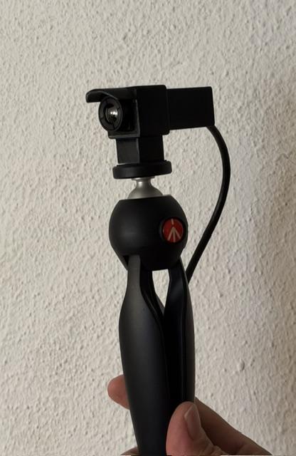
There's a camera mounting fitting underneath so you can can ball joint camera mounts to mount them on and only a little bit sticks up into view.
The 1280x1024 resolution module is a bit bigger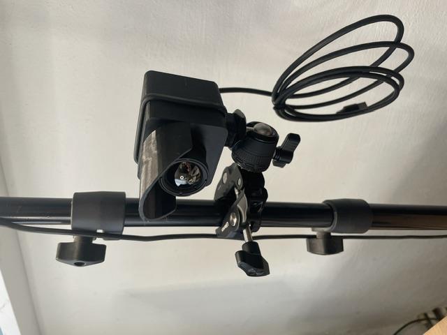

22 June 2026 9:33am
HI
This what I am trying currently todo
I have already some algorithms and some monitoring set up in development
feel free to reach me maybe we could join forces
Project Report: Upgrading Software for The Motus Wildlife Tracking System and NatureCounts
15 June 2026 11:52pm
18 June 2026 10:41pm
Developing an accessible, multi-channel drone telemetry system (Seeking feedback and use-cases)
18 May 2026 8:42am
29 May 2026 4:04am
Hi Robin. Thanks for getting in touch with me and thanks for your information. I also received your contact submission on our website, so I'll chat to you there in more detail.
Simon.
29 May 2026 1:34pm
Hi Simon, this sounds so interesting and is something I've been thinking about for my work in the past.
My team tracks Temminck's pangolins in Malawi using VHF and satellite tags. These animals have been rehabbed and released so we conduct welfare checks on them following release.
Our biggest challenge is that sometimes the satellite tag dies prematurely and then we struggle to pick up VHF signal without knowing an approx sat location. If the terrain is especially hilly then the distance we can pick up VHF signal from is really reduced, especially if the animal is in a burrow. I've previously wondered if a VHF monitoring system is possible with our drone (DJI Mavic 3T).
Your system sounds great and I'm definitely interested in learning more. A 50-100m real-time estimate would work well for us.
17 June 2026 5:05pm
Hi Lea,
Apologies for the late reply, I did not see the notification! I think our system would work well for your use-case. We're designing fittings for multiple drones, one of which is the Mavic 3T.
You're welcome to jump on to our mailing list by heading over to our website. We'll keep you posted with release dates, etc.
10 years later, achievement unlocked! A breakthrough for sea turtle satellite tracking
7 June 2026 1:05am

16 June 2026 12:48am
This post makes me so freaking happy! Glad to have met you through conservation technology discussions all the way over here in Australia back in the early days :) I am also super excited to see your innovations continue.
16 June 2026 2:13pm
Looks very beautiful. Well done.
Poor Rob Appleby. He's just a youngun.
Camera trap recommendations
2 April 2026 11:40pm

15 May 2026 4:12pm
Hi Stephanie, We are manufacturing an innovative AI-powered trail camera called DeterCam, and we are based in the UK: https://innovfactory.com/
The camera is equipped with our Edge AI technology, which allows it to detect only animals and send media (pictures/videos) only when an animal is present in front of the camera. This significantly reduces false triggers and power consumption.
Our Edge AI architecture allows the camera to operate for up to 1 year on battery power (assuming approximately 5 triggers per day). The system also allows full remote control from our cloud platform, including:
• Video duration
• PIR trigger settings
• Detection configuration
• Camera management and updates
The camera is equipped with a 4G module, allowing all media and detections to be uploaded directly to the cloud, meaning there is no need to physically collect data from the SD card.
We supply the complete solution, including manufacturing the battery packs ourselves. The total internal battery capacity can reach up to 32,500 mAh. To date, we have sold over 10,000 units worldwide.
Please let me know if you have any questions.
You can email me if you have any further questions: [email protected]

18 May 2026 6:18pm
Hi, are you looking to import these? Do you have any import tax considerations? This could impact which models you buy. I have been using Acorn models, very reliable and provide photo and 4K video with sound options.
Best wishes
Susan
6 June 2026 3:44am
Thank you everyone for your recommendations! We were awarded the grant, so I will share this information with our team, taking all your advice into consideration with our budget.
Wild Moves and Wild Album: New GBIF Data Portals for Animal Tracking and Camera Trap Data
WILDLABS Team
and 1 more
4 June 2026 6:36pm
Ecologist (Postdoctoral Research Fellow), IS-0408-09
1 June 2026 4:02pm
DIY using SDR connected to a smartphone as a radio telemetry receiver
2 October 2024 5:53am

20 April 2026 3:51am
I wrote a really simple app for Android phones that acts as a telemetry receiver using the RTL-SDL dongles. First version was 5 years ago, and I will admit I didn't really understand what I was doing with the signal processing at the time. I have improved it some, but haven't added all the features I have wanted quite yet. A big change I made was integrating the RTL-SDR android driver directly into my code so a separate package doesn't have to be installed. Some concerns have been brought up, that making a cheap receiver could lead to bad actors using it to find animals, and I have had to sit and debate that. Still, the code for the projects is here:
https://github.com/donfbecker/Telemetry-Receiver
I saw mention of tracking BPM with AI, and I have to say, you don't need AI. Code for this one will not be released until after we finished up a project or two using it (publishing is competative, sometimes you have to keep your advantage). The hardware has a cellular modem in it, so we get updates on BPM (which translates to Body Temperature), every 20 minutes. I had it at 5 minutes, but the solar panels don't keep up as well then. Like I said, no code, but I can give you a teaser of what I have been watching the last few days as our snakes emerge from over wintering.
The main issue with the RTL-SDR is that with the 8bit sampling, you have a noise floor around around -50dB, so you have to have a signal stronger than that to detect it. The built in amplifier amplifies it's own noise as well, so isn't always great. The wideband LNAs that are sold for software radios amplifies EVERYTHING, which sounds great, but isn't. Tracking frequencies often aren't too far off from local FM radio stations in my area, so the LNA amplifies them too. If they get too strong, they saturation the amplifier, and the RF front end on the SDR, basically erasing your signal. The solution is to put a good bandpass filter in front of the LNA, but I've never been able to find one for the frequencies we use, so had to resort to building my own. I only recently figured out the black magic that goes into LC filters, and dealing with all the extra capacitance added by PCBs. I finally have a filter working in the range I need, and will be testing it out on my hardware soon to see how it helps with range.
Overall there is a lot of utility in using the RTL-SDR dongles, but the more I get into it, the more I am trying to design my own SDR hardware. I don't need it to be as capable as the commercially available hardware. I've made a few basic ones already just feeding the output of mixers in to the ADCs on an STM32 microcontroller, using an SI5351 to generate an LO signal for direct converstion. I am going to start playing with using a TLV320ADC audio codec chip to sample signals. It does 32bit sampling, which lowers the noise floor down to -130dB or so, assuming I don't introduce a bunch of noise from my hardware. The sampling rate wouldn't be as fast, but still plenty for picking up the CW pulses from wildlife transmitters.
--Don
P.S. I am recovering from the flu, please ignore typos
18 May 2026 7:11am
How far did you end up taking this project?
29 May 2026 5:22pm
HI Chittakon,
Have you tested the dB gain as that is a measurement of how sensitive the receiver is to pick up a VHF signal. Most commercial grade VHF receiver from telemetry manufacturers are in the -150dbm with a maximum noise figure of 3 dB.
What was the type of VHF transmitters you were using and what was the length of the antenna of the transmitter? Was the transmitter on the ground or position above the ground and if so what height and polarization plane?
There are a lot of variables which determine field range.
Chris Kochanny
Help shape best-practice guidance on conservation technology - input to survey
22 May 2026 10:20am
Engineer Searching for Biologists
20 May 2026 3:18pm
Call for Collaboration: Share your voice at ICTC next week!
11 February 2026 3:29am
19 February 2026 3:35am
Hi Anna!
Is there anything that sparks your curiosity, which I can address for you? Take a look at the upcoming day 2 and day 3 sessions, and if you see anything that intrigues you, please let me know! I'll happily join the session that aligns, and share your thoughts! ☺️
Kind regards,
Mandy
13 May 2026 2:18pm
That's a great idea @MandyEyrich ! Similar to your idea, I wrote up an article with geospatial highlights from ICTC 2026: https://wildlabs.net/en/article/wildlabs-geospatial-group-ictc-2026.
Is the Human-Wildlife Coexistence article available yet? Would love to read it and share it with colleagues at Fauna & Flora.
13 May 2026 2:21pm
@annavallery here's the article with geospatial-ish highlights in case you're interested: https://wildlabs.net/en/article/wildlabs-geospatial-group-ictc-2026. Let me know if you have any questions or specific interests. Happy to share further details!
Open Positions – Postdoc, Technical Staff, and Students (Kyushu University, Japan) Ecological and Cognition Lab (Kano Lab)
9 May 2026 12:23am
Low-cost GPS tracking of giant tortoises
27 April 2025 7:35am
24 April 2026 2:01pm
See the solution below. If the island is within Globalstar’s coverage area, this is definitely the cheapest option: https://interrex-tracking.com/flex-globalstar
30 April 2026 8:13am
Thank you for getting in touch, Marcin. In the meantime I have already found a solution.

2 May 2026 7:01pm
Greetings Lisa, it is interesting to see to the project you are working on. If there's anything I can do to help with my skillset let me know.
Thanks, Mike
Tiger coexistence challenges
20 April 2026 3:20am
2 May 2026 6:32am
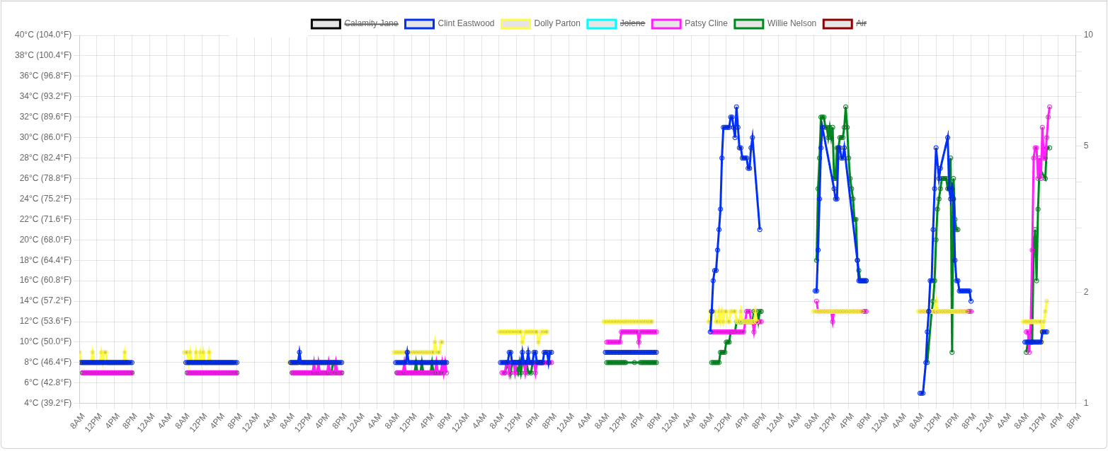
Hi Mandy, writing from Indonesia where we manage the Sumatra Merang Peatland Project (SMPP) which is in a landscape supporting some of the last Sumatran tigers. Our project is part of a corridor including two national parks and a few scattered conservation areas within active oil palm and Acacia plantations. There's not a lot of room for tigers and they do range through human communities or come into contact with plantation workers.
Fatal attacks are rare but two occurred in 2022. We hold annual HWC trainings with communities but also celebrate International Tiger Day with them, having a light-hearted event with games, face paint, and education of the importance of biodiversity, even when scary. We emphasize common sense personal safety measures to reduce the potential for conflict. Luckily livestock aren't very common in this area so that conflict trigger is not a major issue. Mostly it's about restricting activity at dusk/night/dawn, travelling in groups, not running, etc. We haven't found any feasible tech options (tagging is beyond our scope/budget) but we do use camera traps to see if/when tigers are present in/around our project area. This can only do so much for HWC as it's not a rapid response tool but does indicate presence.
Regarding your question "Who/what parties should be held responsible for the loss of life, both human and tiger? Can they be held responsible?" there isn't an easy answer! Indonesian law technically gives tigers the same right-to-life as humans but in practice reprisals of course happen. In our region the military did respond to the 2022 events with patrols and presence, but they were not allowed to shoot. Obviously there is no proactive recourse against the tiger itself as a responsible party. It's an opportunity to redouble efforts on community education to explain why the attacks occurred (both fatalities were at forest frontiers, crouching with back to the forest, etc) and how to avoid re-occurrence!
Biodiversity Lab Manager
Open PhD project: Decoding and mapping Earth's species interactions with ecological AI
28 April 2026 4:51pm
Animal Movement Group Meetup: R packages, data and code integration in animal movement ecology
Ecological Data Scientist
21 April 2026 9:22pm
Looking To Connect: Game Developer to Conservation Tech (Built Animal Movement App)
3 December 2025 1:10am

29 December 2025 8:38pm
Hi Kristof,
Very cool that you made your own app like this! I'm not a movement ecologist, but I'd generally say this sort of thing will be more nice to look at than solves research questions. For example, most statistical models will show that proximity to water and human development are the strongest predictors of elephant movement. But it's still a very cool tool for outreach and communication with the general public or conservation decision makers!
I can imagine a visualization like this being very helpful in communicating drivers of human-elephant conflict in SE Asia, where elephant movements outside of protected areas may be explained by the combination of attractive food crops, accessible water and shade refuge in tree plantations, and repulsive hazing by farmers. These sorts of things that can be modeled statistically don't necessarily translate well to the public - so visualization is really important!
On a non-geospatial note, I would say that AR/VR also has a lot of potential for increasing public engagement/support for conservation. Getting individuals who may never go to East Africa to experience visually how increasingly severe droughts affects the landscape and promotes conflict between pastoralists and agriculturalists and wildlife could be really powerful. That's perhaps an area where game development expertise would be particularly useful.
Cheers,
Brandon
20 April 2026 4:05am
I am glad to see more programmers coming into the conservation field. The first big project I did that really got me involved with conservation work, was taking the path finding algorithms I used from learning game programming, and using them to detect and measure the distance of routes that turtles traveled up and down streams in a river drainage.
20 April 2026 7:39am
Wolves, cool!
Will this then need collared wolves ?
Anyone here in Jaipur??
18 April 2026 3:58pm
The Hidden World of Sensitive Species Data
10 April 2026 4:03pm
Remote Geospatial Software Developer with TerrAdapt
2 April 2026 1:51pm
Remote Senior Scientist with TerrAdapt
2 April 2026 1:48pm
I WANT TO TELL YOUR STORY

29 June 2025 10:22am

1 October 2025 7:43am
I'm not involved with this, but I just learned about Sea Shepherd today and their project to fight illegal octopus trapping. Sorry I can't help with an intro, but it would be a very cool story to share if you can get in touch!

11 January 2026 7:33am
Amazing!
Found your instagram page and have been scrolling all morning ( most educative doomscrolling I've done so far😂). Love it, am seeing sea creatures I've never seen.

24 March 2026 1:37pm
Wonderful work! Would you be interested in documenting a story about afforestation from the Pacific Ocean to the Himalayas (Indus River focus)?
I’m interested in doing an expedition documentary bridging mythology and conservation with a YouTuber to help bring awareness towards forest conservation all along the river. The focus is water and water wildlife.
Looking To Utilize My Skillsets To Help
19 March 2026 10:26pm
Seeking input: Help shape the future of Movebank

19 March 2026 7:59pm
Acoustic recording tags for marine mammals (soundscape research)

5 June 2025 6:04pm
8 February 2026 11:31pm
Hi,
Perhaps this is a tad late for you Maggie, but sharing in case this post comes up in a future search. Project CETI just released a fully open-source biologger, both hardware and software. Pretty cool. Here are the links:
An open-source bio-logger for studying cetacean behavior and communication | PLOS One
Over the past decade, bioacoustics associated with diverse marine life has become the focus of increasing research. While fixed acoustic devices play important roles in characterizing localized soundscapes, animal-worn devices that record audio alongside physiological metrics provide richer portals to understanding cetacean communication and characterizing sounds in their environment. To facilitate scaling the collection of such multimodal datasets for deep learning applications and to encourage rapid prototyping for new recording capabilities, we present an open-source non-invasive bio-logger that can be deployed on marine animals to record high-quality audio synchronized with an extensible suite of behavioral and environmental sensors. The current implementation is tailored to investigating sperm whale communication and biology. It features four suction cups, three high-bandwidth synchronized hydrophones for audio analysis including directionality, GPS logging and transmission, and sensors for pressure, motion, orientation, temperature, and light. Its hardware and software are both open-source, with designs, fabrication details, and code available online. Lab-based experiments characterize and validate performance including shear adhesion forces, withstanding pressures equivalent to 560 m depths, battery life up to 16.8 hours, audio sensitivity of –205 dB re FS/μPa with a 96 dB dynamic range, multi-threaded data acquisition, drone-based deployments, and GPS-based recoveries. Field experiments record sperm whale vocalizations and behaviors spanning 10 deployments, 44 hours of recording, 20 dives, and up to 967 m depths. Altogether, this platform aims to advance the understanding of marine animal biology and communication within the rapidly evolving and intersecting areas of robotics, bioacoustics, and machine learning.

Tapping Into Whale Talk
Open-source bio-logger captures underwater cetacean conversations

19 March 2026 7:19pm
I found this article on Hackaday a while ago:
The Gladys Hydrophone : 12 Steps (with Pictures) - Instructables
The Gladys Hydrophone: It is time to update my Hydrophone Instructables. My first Hydrophone Instructable is a few years old at this point. Many were built and used around the globe. One of the first things I learned was that there needs to be a ground connection fro…

It may be possible to install some of these in a semi-fixed location and then use them to generate baseline data in conjunction with observations.
For example, six or seven locations along with a population study would let you get a very coarse heatmap of areas that animals avoid.
19 March 2026 7:20pm

20 June 2026 9:36am
I'll definitely check out your channel! To be honest, I'm much more on the animal science and behaviour side of things than the hardware engineering side, so I can't speak to the exact specs of the older gear I've seen, but having that high of a resolution without motion blur definitely sounds like a massive leap forward.
The way I see it, the trickiest part about any remote tech, no matter how high-res it gets, is that you can never truly measure the 'avoidance factor' from behind the lens. If a cautious animal senses a foreign object in its home ground and decides to completely steer clear of that zone, the camera will never catch it. You only ever get data on the animals that don't mind the camera, which can unintentionally skew the behavioural picture.
It’s the classic observer dilemma. It’s why some of the most famous animal behaviourists in history only truly understood nuanced behaviour by actually embedding themselves in the environment and becoming part of the pack, rather than relying solely on a fixed lens. But as a tool to bridge the gap where humans can't go, it's definitely exciting to see how much clearer the visibility is getting!