GIS, or Geographic Information Systems, play a crucial role in nature conservation. Every day, mapping and spatial analysis are aiding conservation decisions, protected areas designation, habitat management on reserves and monitoring of wildlife populations, to name but a few examples. Want to learn more about how remote sensing is used in conservation? Check out the first two episodes of this season of Tech Tutors, where our Tutors answer the questions How do I use open source remote sensing data to monitor fishing? and How do I access and visualise open source remote sensing data in Google Earth Engine?
You can also check out our Virtual Meetup Archive for a range of panels that overlap with Remote Sensing & GIS topics.

- 0 Resources
- 0 Discussions
- 7 Groups

- @lucytallents
- | She/Her
VerdantLearn
Sociable e-learning for conservation capacity building
- 0 Resources
- 4 Discussions
- 4 Groups

São Paulo State University (UNESP)
- 0 Resources
- 0 Discussions
- 7 Groups

World Wide Fund for Nature/ World Wildlife Fund (WWF)

- 0 Resources
- 2 Discussions
- 9 Groups
World Wide Fund for Nature/ World Wildlife Fund (WWF)
- 0 Resources
- 2 Discussions
- 9 Groups

Wildlife conservationist currently working on biodiversity monitoring and community development for AFOLU VCS & CCB projects.
- 0 Resources
- 0 Discussions
- 14 Groups

- @QuestionLake
- | she/her
@alaska_melanie | Geospatial ecologist, conservationist, cartographer, birder. Program Director, Bird Migration Explorer @audubonsociety.
- 0 Resources
- 0 Discussions
- 1 Groups
- @shouldusedecimal
- | he/him
- 0 Resources
- 3 Discussions
- 5 Groups

- 0 Resources
- 0 Discussions
- 8 Groups
- @drolnick
- | he/him
- 0 Resources
- 0 Discussions
- 5 Groups

- @Bbackiel
- | she/her
Landscape ecologist + Geospatial analyst
- 0 Resources
- 0 Discussions
- 3 Groups

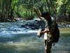
I'm a recent graduate with an applied degree in GIS and am looking to volunteer my time as a GIS tech or analyst. I love all things nature and watching the wildlife in our backyard. I have set up our webcam from time time trying to lure the wildlife for a good image.
- 0 Resources
- 1 Discussions
- 7 Groups
Careers
The Smithsonian’s National Zoo and Conservation Biology Institute (SNZCBI) is seeking two postdoctoral fellows to engage more directly with identifying conservation metrics for vertebrate communities and populations.
14 March 2024
Careers

The Max Planck Institute of Animal Behavior at its sites in Constance and Radolfzell offers an international, interdisciplinary, and collaborative environment that opens up unique research opportunities. The goal of our...
13 March 2024
Careers
Texas A&M is seeking applicants for a fully funded Ph.D. assistantship to begin a long-term study on collared peccary (also known as javelina) ecology in southern Texas.
13 March 2024
Article
Emerging trends for Nature-Based Solutions project assessments
8 March 2024
Careers
Machine Learning Postdoc Position, Understory

Ross Davison
Join us to help prevent biodiversity loss! Understory is hiring a postdoc to lead R&D Development on generalizing Computer Vision models for vegetation identification across space/time/phenotypes.
29 February 2024
Article
Data data everywhere, but not a byte to use!

Cassie Anderson
Is there really a sustainability data deficiency? We don’t think so.
29 February 2024
Careers
Join the Luxembourg Institute of Science and Technology (LIST) in pioneering environmental and ecological monitoring! 🌍💡 As part of ERIN’s Observatory for Climate, Environment, and Biodiversity (OCEB), you'll be at the...
26 February 2024
Article
Scaling biodiversity scoring for supply chains aligned with TNFD
Cassie Anderson
How Earth Blox reduced biodiversity impact analysis from 2 months to 1 hour for a global bank.
20 February 2024
Careers

The primary focus of the research is to explore how red deer movements, space use, habitat selection and foraging behaviour change during the wolf recolonization process.
10 February 2024
Careers
The Wildlife Restoration Foundation is hiring a Conservation Technology Intern
8 February 2024
Careers
New position available in Esri’s Nonprofit account team.
8 February 2024
Article
Using geospatial data and the TNFD L.E.A.P approach to assess nature-related risks, impacts and opportunities in supply chains.
4 January 2024
June 2024
event

Cassie Anderson
July 2024

September 2024

October 2022
event

Stephanie O'Donnell
event
Stephanie O'Donnell
July 2022
event

Carly Batist
112 Products
Recently updated products
| Description | Activity | Replies | Groups | Updated |
|---|---|---|---|---|
| Unfortunately I may fail to deliver so I cannot take it up. Am off net at times for two weeks straight. But excited about everything GIS so I follow keenly. Thank you... |
|
Remote Sensing & GIS | 4 days 13 hours ago | |
| Depending what you want to do, there are free services to annotate values for each point, interpolating between available time-location records in the RS data.The EnvDATA Track... |
|
Remote Sensing & GIS | 2 weeks 4 days ago | |
| Hi folks!@Chelsea_Smith from Fauna & Flora joined last month's variety hour to share more about Fauna & Flora's work with... |
|
Remote Sensing & GIS, Data management and processing tools, Protected Area Management Tools | 1 month 2 weeks ago | |
| Calling practitioners working in connectivity... we're doing some thinking around modelling functional connectivity, and the data that... |
|
Remote Sensing & GIS | 1 month 3 weeks ago | |
| Thank you Carly, I will definitely take a look. |
|
Acoustics, Biologging, Climate Change, Conservation Tech Training and Education, Data management and processing tools, Remote Sensing & GIS, Software and Mobile Apps | 2 months 2 weeks ago | |
| We will be conducting in-person demos of our cutting-edge drone technology in the US this year! 🇺🇸 If you're interested in experiencing... |
|
Biologging, Drones, Remote Sensing & GIS, Software and Mobile Apps | 3 months 3 weeks ago | |
| Am working on similar AI challenge at the moment. Hoping to translate my workflow to wolves in future if needed. We all are little overstretched but it there is no pressing... |
|
Camera Traps, AI for Conservation, Build Your Own Data Logger Community, Data management and processing tools, Marine Conservation, Protected Area Management Tools, Remote Sensing & GIS | 4 months 1 week ago | |
| Real nice video. I'll have another look in the weekend in detail. |
+10
|
Acoustics, Community Base, Protected Area Management Tools, Remote Sensing & GIS, Sensors | 4 months 1 week ago | |
| Hi!I would take a look at Although developed for camera trap imagery, it is by no means restricted to such.Cheers,Lars |
|
Camera Traps, Community Base, Data management and processing tools, Drones, Emerging Tech, Remote Sensing & GIS, Software and Mobile Apps | 4 months 1 week ago | |
| Thank you for the links. As a trainer in GIS I have gone through them and they are very helpful for a beginner in QGIS. |
|
Remote Sensing & GIS | 4 months 2 weeks ago | |
| Thank you for this! Will take a look. |
|
Climate Change, Conservation Tech Training and Education, East Africa Community, Remote Sensing & GIS | 4 months 3 weeks ago | |
| Appreciate that Lars! |
+20
|
Biologging, Remote Sensing & GIS | 5 months ago |