In recent years, drone technologies have been explored for a range of applications in conservation including (but not limited to) mapping, biodiversity inventories, antipoaching patrols, wildlife tracking, and fire monitoring. The rise of customizable, open-source drones like those of ArduPilot and OpenROV hold promise for more effective conservation applications, and combined with other monitoring sensors and devices, they are capable of collecting high-resolution data quickly, noninvasively, and at relatively low cost.
However, challenges remain in putting these tools to use. A recent paper reviewing 256 conservation drone projects highlighted some of these major obstacles, ranging from unintended social and ecological consequences of drone operations to still prohibitive costs, both in terms of hardware and in terms of storing and processing large volumes of data. The longstanding challenge of power/battery life remains as well.
If you're considering trying out drones for yourself, and want to explore the possibilities and understand the major conversations happening around this technology, check out these beginner's resources and conversations from across the WILDLABS platform:
Three Resources for Beginners:
- Conservation Technology User Guidelines Issue 5: Drones, World Wildlife Fund | Drones, best practices, ethics, regulations, case studies
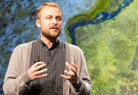
- WILDLABS Virtual Meetup Recording: Drones, Craig Elder, Dr. Claire Burke, and Gabriel Levin | Drones, thermal camera, wildlife crime, ML, biologging
- New Paper: Drones and Bornean Orangutan Distribution, Sol Milne | Drones, data analysis, citizen science, community science, primates
Three Forum Threads for Beginners:
- Curious about radio-tracking with drones? | Wildlife Drones, Biologging (5 replies)
- Drones for GIS Best practice Document | Adrian Hughes, Drones (10 replies)
- WWF Conservation Technology Series: Drones in Conservation | Aurélie Shapiro, Drones (7 replies)
Three Tutorials for Beginners:
- How do I use a drone to capture radio-tracking data? | Debbie Saunders, Tech Tutors
- How do I choose the right drone for my conservation goals? | Shashank Srinivasan, Tech Tutors
- How do I strategically allocate drones for conservation? | Elizabeth Bondi, Tech Tutors
Want to know more about using drones, and learn from experts in the WILDLABS community? Make sure you join the conversation in our Drones group!
*Header photo: Parker Levinson, Point Blue Conservation Science

- 0 Resources
- 0 Discussions
- 5 Groups

- @Gcharron
- | Mr.
Cofounder of Outreach Robotics, I have a master in mechanical engineering and I thrive on developing new technology for field scientists using remote controlled robots.
- 1 Resources
- 1 Discussions
- 4 Groups

M.A.P Scientific Services
Co-founder and Director of M.A.P Scientific Services, South Africa
- 0 Resources
- 0 Discussions
- 8 Groups

- 1 Resources
- 5 Discussions
- 4 Groups

- @Gody
- | He
Godfrey Nyangaresi, a dedicated Protection Manager with 12+ years of wildlife conservation experience. Skilled in technologies, administration, and law enforcement, he leads protection efforts at STEP, ensuring the sustainable conservation of elephants in southern Tanzania.
- 0 Resources
- 3 Discussions
- 17 Groups

- @Mathilde
- | she/her
Natural Solutions
Engineer, I work for a web development company on web application projects for biodiversity conservation. I'm especially interested by camera traps, teledetection and DeepLearning subjects.
- 0 Resources
- 0 Discussions
- 11 Groups

WildTrack
Research, development and implementation of non-invasive montoring for endangered species


- 0 Resources
- 25 Discussions
- 12 Groups
- 0 Resources
- 0 Discussions
- 6 Groups
- @kricherds
- | she/her
Technology advisor for social change

- 0 Resources
- 0 Discussions
- 13 Groups

My name is Ann Wambui ,a conservationist working as a conservation officer at Mugie Conservancy. Am a Diploma holder specialized in Wildlife Management from the Wildlife Research Training Institute. Currently, am Distance Learning student at the Africa Nazarene University.

- 1 Resources
- 5 Discussions
- 9 Groups

- @dilip_singh556
- | Him
On the way to Bridge technology and Nature.
- 0 Resources
- 2 Discussions
- 10 Groups

- 0 Resources
- 14 Discussions
- 3 Groups
Careers

Fauna & Flora International is seeking a qualified candidate for the position of a Technical Specialist, Analytics to support and grow the use of spatial technologies and analyses for conservation planning and...
21 March 2022
Article
Technical Difficulties: Cleared for Takeoff

Eric Becker
In their three-part interview from our new series Technical Difficulties, Colby Loucks and Eric Becker share the failures they've encountered and learned from throughout six years of working on the WWF-US Wildlife Crime...
20 October 2021
Article
Technical Difficulties: Understanding the Realities

Colby Loucks
In their three-part interview from our new series Technical Difficulties, Colby Loucks and Eric Becker share the failures they've encountered and learned from throughout six years of working on the WWF-US Wildlife Crime...
13 October 2021
Article
New Papers: Remote Sensing in Ecology and Conservation

Remote Sensing in Ecology & Conservation
ZSL's Remote Sensing in Ecology and Conservation journal has released new research for early view before inclusion in an issue. See the full list of recent open access research papers on RSEC.
22 April 2021
Funding
Funding Opportunity: COVID-19 Science Fund

National Geographic
National Geographic is offering funding up to up to $50,000 for conservationists conducting research on how the pandemic has impacted wildlife and conservation work. If you are interested in researching aspects of the...
10 March 2021
Article

How can drones and ATVs protect black-footed ferrets from the plague? In this case study from WWF's Northern Great Plains Program, Black-footed Ferret Restoration Manager Kristy Bly discusses how delivering vaccines to...
17 February 2021
Article

Sol Milne's new paper, Drivers of Bornean Orangutan Distribution across a Multiple-Use Tropical Landscape, is now available. Using drones to detect orangutan nest density in aerial surveys (as shared during our...
12 February 2021
Article
Press Release: BAS Giant Iceberg Mission

British Antarctic Survey
A research mission to determine the impact of the giant A-68a iceberg on one of the world’s most important ecosystems using underwater robotic gliders gets underway this January. A team of scientists, led by British...
13 January 2021
Article
Conservation Technology User Guidelines Issue 5: Drones
World Wildlife Fund
The latest issue of WWF's Conservation Technology Series is about drones and is designed for a broad audience of conservationists. Containing ten case studies, scientific literature, and handy information on getting...
18 November 2020
Article
Report: Helping Ensure Ethical Indian Drone Operations

Shashank Srinivasan
As drone usage continues to grow within the conservation tech community, driven by improved performance, increased accessibility, and the wide range of data collection methods that can be served by drones, so do the...
19 October 2020
Article
#Tech4Wildlife News: Airdropping Sensors from Moths

University of Washington
The miniaturisation of technology is rapidly opening up new possibilities for conservationists and environmental scientists in need of less invasive, easy to deploy solutions. University of Washington researchers have...
13 October 2020
Article
Sustainable Fishing Challenges: Fishing Gear Innovations

Daniel Steadman
Today, Sustainable Fishing Challenges group leader Daniel Steadman discusses how fishing gear itself could benefit from fresh technological innovations to prevent both environmental damage and damage to species and...
19 August 2020
July 2023
June 2023
event

Stephanie O'Donnell
29 Products
Recently updated products
| Description | Activity | Replies | Groups | Updated |
|---|---|---|---|---|
| Stefano Puliti joined Variety Hour to share his work using 3D photogrammetric data from UAVs for pre- and post-harvest inventory of forest... |
|
Climate Change, Data management and processing tools, Drones, Remote Sensing & GIS | 8 months ago | |
| Hi Doug,we are a young startup that uses AI as a tool in nature and wildlife conservation. At the moment we develop a drone with on-board AI (for object detection) and thermal and... |
+1
|
Drones | 9 months 1 week ago | |
| During Andrew's talk, @dmorris put out a call in the chat that might be relevant to folks catching up on the video, so I'll drop it here too: Re: Andrew's fish work... part... |
|
AI for Conservation, Camera Traps, Drones, Marine Conservation | 10 months 3 weeks ago | |
| Carly, that would be great! Thanks! I work with soundscapes and love the work of Rainforest Connection! I'll send you an email (@CUNY) to coordinate! |
|
Acoustics, AI for Conservation, Conservation Tech Training and Education, Drones, eDNA & Genomics, Emerging Tech, Remote Sensing & GIS | 1 year ago | |
| Hi Donya! You might check out the Conservation Tech Directory to see what projects/organizations/tools best align with your interests and skills. |
|
Acoustics, AI for Conservation, Camera Traps, Drones | 1 year ago | |
| Do you have a wild animal tracking story that involves adventure or misadventure? Share it with us! From going around in circles for hours... |
|
Biologging, Citizen Science, Drones, Remote Sensing & GIS | 1 year ago | |
| GeoNadir and OpenDroneMap might be of interest for drones?The Conservation Tech Directory might have some additional projects/tools of note. |
|
Data management and processing tools, Drones | 1 year 1 month ago | |
| Seeing the pictures that @lmccaskill uploaded got my brain storming, so to say. Are you working with similar small boats? I was assuming bigger fishing ships that are registered... |
|
Drones, Marine Conservation, Wildlife Crime | 1 year 1 month ago | |
| Following up here... a few of us huddled virtually and assembled standardized metadata, standardized sample code, and sample annotated images for all the datasets on that list.... |
|
Drones | 1 year 1 month ago | |
| Hi Jeremy, With a quick search I've found the paper linked below. It looks like equipments such as Livox MID are sufficient for plot-level analyses, but not for individual... |
|
Drones, Earth Observation 101 Community, Emerging Tech, Remote Sensing & GIS, Sensors | 1 year 2 months ago | |
| Thank you so much for your reply! I'll look in to this now :) |
|
Acoustics, Autonomous Camera Traps for Insects, Camera Traps, Data management and processing tools, Drones, Remote Sensing & GIS, Software and Mobile Apps | 1 year 2 months ago | |
| I couldn't agree more with both of these comments tom! I'm reading hundreds (literally hundreds) of applications for open WILDLABS roles at the moment, and the ones that stand out... |
+2
|
AI for Conservation, Drones, Early Career, Sensors | 1 year 2 months ago |


April Meetup: Can UAVs be used to measure forest quality?

24 May 2016 2:06pm
Great article talking about applying drones to scientific research

13 April 2016 6:30pm
Can UAVs be Used to Measure Forest Quality?
 Tom Swinfield
27 April 2016 12:00am
What to you is the biggest small problem with using UAVs in the field?
24 February 2016 7:47pm
5 April 2016 5:17pm
Wait, can you implement the range extenders in DJI systems? Is it costly in order to do so?

5 April 2016 5:58pm
jprobert,
Due to the proprietary nature of DJI, no the antenna tracker listed above cannot be added easily. Some engineering would need to go into hacking DJI. I'm not sure if you can get the telemetry data from DJI's app or ground control station. If so, one could parse the telemetry data and feed the GPS location into the open source tracker. You could also add another radio on board which transmits the GPS from the UAV. However, this is not the most efficient way and will cost some flight time for the added weight and power consumption.
Without hacking DJI or doing some digging, you could replace the antennas on the hand controller and UAV with higher gain antennas. This could improve range, but would limit the directions you could fly(directional antenna).
I will look into data provided by DJI and see what it possible.

26 April 2016 9:34am
I agree that it is likely that a dirigible would probably struggle in a lot of common mapping settings. People do use kites though. If you are interested in developing the flight control systems for dirigibles though I would also suggest that the best place to start is Ardupilot.
Automated Forest Restoration with Drones

10 March 2016 4:59pm
13 April 2016 10:56am
Hi Lot, great to see you here too.
Collecting Your Opinions about Drones

11 April 2016 6:52pm
12 April 2016 9:26am
Hi Sean,
Thanks for sharing your survey - is there a specific date you'll be closing the survey?
It'd be great if you could share the results of the survey here, as I (for one) will be quite interested to see what comes back.
Cheers,
Steph
Solar powered drone for conservation

16 March 2016 4:17pm

26 March 2016 12:03pm
Hey Gregg,
The project looks cool!
Just wondering how much you envisage the load carrying capacity of the drone to be? So being able to carry cameras, GPS, etc.
Also, do you see the price coming down later? $5000 sounds quite steep...
And finally, have you thought about creating it as an open source project? Since all the perks at this points are mostly symbolic, this way people would be more compelled to contribute.
Have a nice day,
Daniel
28 March 2016 12:27pm
Hi Daniel
Thanks for the interest in the project.
The load carrying capacity will be a few kgs. The battery I've sized at this stage is around 2kgs and should allow it to fly over night, but if this storage is increased in future it will impact the other loads. It is a tricky trade-off between flight time and capability.
I'm hoping to include both visual and thermal cameras on a gimbal but they will need to be miniature versions (adds to cost). The drone will definitely include GPS/autopilot and I'm also hoping to include onboard image processing in future so the drone can send an alarm when it notices something out of place. The video feed will also need to be encrypted so that poachers cannot use the drone as their own scouting vehicle.
The price tag of $5000 is for the first few prototypes and will come down with mass production and buying in bulk. I don't see it dropping much below $3000-4000 at current equipment prices though. For instance, the solar PV cells and charge circuit alone will cost around $1000 and the cost of even the cheap uncooled microbolometer therml imagers is over $1000. This isn't an average consumer drone but I've tried to keep the costs down as much as possible so it's feasible. I've also considered offering a stripped down drone of just the charging circuit and airframe so that people can add their own equipment and autopilot etc.
In terms of the perks, I tried to model this campaign after other campaigns that had a product already, which has been a mistake. The build diary included in some of the perks was my attempt at making it open source. I am considering reworking all the perks as it is unlikely to get any funding at this stage.
Thanks for the valuable feedback. Please let me know if you have any other questions or comments.
Cheers,
Gregg
Integrating UAV imagery into ArcGIS
1 March 2016 2:34pm
SnotBots: Can drones transform whale conservation?
25 February 2016 12:00am
Bringing Conservation Technology to Life
 Shah Selbe
17 February 2016 12:00am
PhD Positions: UAVs and Wild Animal Tracking Systems

2 February 2016 10:13pm
DJI and Ford launch a competition with $100,000 prize
12 January 2016 2:59pm
Achieving Moonshots: Advancing Humankind and Preserving Nature
22 December 2015 12:00am
Cheap Space, DIY Imaging and Big Data
21 December 2015 12:00am
Drones as elephant deterrent (herding device)

24 November 2015 6:32pm
17 December 2015 6:39pm
Hi Dave,
I believe with any DJI drones you can plot out the course of a drone and let it fly along the route with you controling the speed and height of the drone. The limitation is that it has to eb within a mile of the pilot.
Regards,
John
17 December 2015 6:43pm
True, but ideal the navigation system would need to be more interactive to be able to respond to the elephant movements in real-time.
The Social Lives of Conservation Technologies and Why They Matter
 Chris Sandbrook
2 November 2015 12:00am
3 May 2016 9:16am
Interesting. A case in point is the viral video making the rounds about drone fishing:
We've seen an array of inventive uses for drones of late across a whole range of endeavors, often having direct or indirect implications for natural resource management. Using drones to improve our ability to target/hunt species of concern seems at once both a natural progression and something new with a slightly ominous overtone. This strikes me as one of those moments where we might want to pause and take stock of what is going on with this technology and where it might go in the not too distant future.
Should we ignore this development? Work to restrict the use of drones for such activities? Support this? Regardless of where we might come down on this question, I can't help but fell that this notion of drone fishing certainly seems to have the sense of "crossing the Rubicon" somehow.
http://aarr.piratelab.org/news/drone-fishing/