GIS, or Geographic Information Systems, play a crucial role in nature conservation. Every day, mapping and spatial analysis are aiding conservation decisions, protected areas designation, habitat management on reserves and monitoring of wildlife populations, to name but a few examples. Want to learn more about how remote sensing is used in conservation? Check out the first two episodes of this season of Tech Tutors, where our Tutors answer the questions How do I use open source remote sensing data to monitor fishing? and How do I access and visualise open source remote sensing data in Google Earth Engine?
You can also check out our Virtual Meetup Archive for a range of panels that overlap with Remote Sensing & GIS topics.

Natural Solutions
Engineer, Ph.D in Computation Ecology. Interested in developing tools for the massive acquisition of high dimensional data from new technologies (e.g., imaging, omics), their analysis and visualization.
- 0 Resources
- 0 Discussions
- 13 Groups

- @Gody
- | He
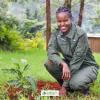
Godfrey Nyangaresi, a dedicated Protection Manager with 12+ years of wildlife conservation experience. Skilled in technologies, administration, and law enforcement, he leads protection efforts at STEP, ensuring the sustainable conservation of elephants in southern Tanzania.
- 0 Resources
- 3 Discussions
- 17 Groups

- @Mathilde
- | she/her
Natural Solutions
Engineer, I work for a web development company on web application projects for biodiversity conservation. I'm especially interested by camera traps, teledetection and DeepLearning subjects.
- 0 Resources
- 0 Discussions
- 11 Groups

Director of Spatial Planning and Innovation Nature Conservancy of Canada
- 0 Resources
- 0 Discussions
- 12 Groups
- @CarlosAbrahams
- | He/him
Baker Consultants
Director of Bioacoustics and Senior Lecturer

- 2 Resources
- 24 Discussions
- 4 Groups
- @kricherds
- | she/her
Technology advisor for social change

- 0 Resources
- 0 Discussions
- 13 Groups

- @Muzna
- | She, Her
Muzna Kashaf is a dedicated herpetologist who recently achieved her MPhil, showcasing her commitment to advancing knowledge in the field. Her research focus lies in amphibians, and she has utilized Geographic Information Systems (GIS) to enhance precision of her studies.
- 0 Resources
- 0 Discussions
- 2 Groups

My name is Ann Wambui ,a conservationist working as a conservation officer at Mugie Conservancy. Am a Diploma holder specialized in Wildlife Management from the Wildlife Research Training Institute. Currently, am Distance Learning student at the Africa Nazarene University.

- 1 Resources
- 5 Discussions
- 9 Groups

- @diyaquanauts
- | he / him
Digital nomad, software developer, running mechatronic engineering firm in Seychelles to assist ocean conservation groups.
- 0 Resources
- 7 Discussions
- 9 Groups
- 0 Resources
- 0 Discussions
- 3 Groups
A Wildlife Biologist interested in Environment Assessment and Restoration, In-situ and Ex-situ strategies, Technologies used in Conservation and Illegal Wildlife Trade.
- 0 Resources
- 5 Discussions
- 13 Groups
- @otgonbayartm
- | He / His
Thanks to WILDLABS. This community is what exactly matches to my interest in Nature Conservation as IT professional.
- 0 Resources
- 0 Discussions
- 7 Groups
Careers
Consultancy opportunity: Wildlife monitoring specialist

Anthony Dancer
Consultancy opportunity at ZSL for an experienced monitoring specialist to support species monitoring in rewilding landscapes across Europe
31 January 2023
Article

Meet the women and men supporting gender equality in conservation #tech. Here is a panel discussion the Women in Conservation Tech (WiCT) led in November 2022, during the EarthRanger User Conference (ERUC). Opening up...
30 January 2023
Careers
Conservation Technology Intern (Vietnam)
Meredith Palmer
WILDLABS and Fauna & Flora International are seeking an early career Vietnamese conservationist for 12-month paid internship position to grow and support the Southeast Asia regional community in our global...
11 January 2023
Careers
Join NASA’s harmful algal bloom ML challenge and win prizes!

Katie Wetstone
Using satellite imagery to detect and classify the severity of cyanobacteria blooms in small, inland water bodies.
15 December 2022
Careers
Spatial Data Analysis, TNC

The Nature Conservancy
Working with a team of conservation practioners, scientists, and technologists, the Spatial Data Analyst uses leading-edge earth observation data in new and effective ways to inform conservation practice locally,...
8 November 2022
Article
This SPACES paper aims to inspire the audience to use spatial intelligence as an enabler for integrated nature and climate action. It showcases ’emerging’ data sources and digital technology in the nature and climate...
28 October 2022
Article
New conservation tech articles from Mongabay

Carly Batist
Five articles that include conservation tech published at Mongabay
20 October 2022
Careers
Conservation Technology Intern (Vietnam)

Meredith S. Palmer
*New closing date!* WILDLABS and Fauna & Flora International are seeking an early career conservationist for 12-month paid internship position to grow and support the Southeast Asia regional community in our global...
19 October 2022
Careers
GIS & Data Science Specialist, Island Conservation
Carly Batist
The candidate will partner with our global team members that are focused on designing and implementing island restorations using the most effective, science-based, cost-efficient, and collaborative methods available.
14 October 2022
Careers
Senior GIS Officer - GIS Engineer

Stephanie O'Donnell
Rainforest Alliance is seeking a Senior GIS Officer, based in the Netherlands, Germany, or Belgium
11 October 2022
Careers
GIS Officer
Stephanie O'Donnell
Rainforest Alliance is seeking a GIS Officer based in the Netherlands, Germany, or Belgium
11 October 2022
Article
The planet matters. People matter. Location matters.

Floor van Dam
This paper released by the World Economic Forum and the SPACES coalition shows how businesses can embrace the use of spatial intelligence for action on nature and climate. How can we make sure businesses apply the...
23 September 2022
June 2024
event

Cassie Anderson
July 2024

September 2024

September 2023

event

Stephanie O'Donnell
event
Cassie Anderson
112 Products
Recently updated products
| Description | Activity | Replies | Groups | Updated |
|---|---|---|---|---|
| Unfortunately I may fail to deliver so I cannot take it up. Am off net at times for two weeks straight. But excited about everything GIS so I follow keenly. Thank you... |
|
Remote Sensing & GIS | 4 days 13 hours ago | |
| Depending what you want to do, there are free services to annotate values for each point, interpolating between available time-location records in the RS data.The EnvDATA Track... |
|
Remote Sensing & GIS | 2 weeks 4 days ago | |
| Hi folks!@Chelsea_Smith from Fauna & Flora joined last month's variety hour to share more about Fauna & Flora's work with... |
|
Remote Sensing & GIS, Data management and processing tools, Protected Area Management Tools | 1 month 2 weeks ago | |
| Calling practitioners working in connectivity... we're doing some thinking around modelling functional connectivity, and the data that... |
|
Remote Sensing & GIS | 1 month 3 weeks ago | |
| Thank you Carly, I will definitely take a look. |
|
Acoustics, Biologging, Climate Change, Conservation Tech Training and Education, Data management and processing tools, Remote Sensing & GIS, Software and Mobile Apps | 2 months 2 weeks ago | |
| We will be conducting in-person demos of our cutting-edge drone technology in the US this year! 🇺🇸 If you're interested in experiencing... |
|
Biologging, Drones, Remote Sensing & GIS, Software and Mobile Apps | 3 months 3 weeks ago | |
| Am working on similar AI challenge at the moment. Hoping to translate my workflow to wolves in future if needed. We all are little overstretched but it there is no pressing... |
|
Camera Traps, AI for Conservation, Build Your Own Data Logger Community, Data management and processing tools, Marine Conservation, Protected Area Management Tools, Remote Sensing & GIS | 4 months 1 week ago | |
| Real nice video. I'll have another look in the weekend in detail. |
+10
|
Acoustics, Community Base, Protected Area Management Tools, Remote Sensing & GIS, Sensors | 4 months 1 week ago | |
| Hi!I would take a look at Although developed for camera trap imagery, it is by no means restricted to such.Cheers,Lars |
|
Camera Traps, Community Base, Data management and processing tools, Drones, Emerging Tech, Remote Sensing & GIS, Software and Mobile Apps | 4 months 1 week ago | |
| Thank you for the links. As a trainer in GIS I have gone through them and they are very helpful for a beginner in QGIS. |
|
Remote Sensing & GIS | 4 months 2 weeks ago | |
| Thank you for this! Will take a look. |
|
Climate Change, Conservation Tech Training and Education, East Africa Community, Remote Sensing & GIS | 4 months 3 weeks ago | |
| Appreciate that Lars! |
+20
|
Biologging, Remote Sensing & GIS | 5 months ago |


Basic GIS vector and raster datatsets

7 November 2016 1:47pm
How do Wildlife Crime Experts view Remote Sensing Technologies used to Combat Illegal Wildlife Crime?
7 November 2016 12:00am
Earth Observation from Space: the Optical View

22 September 2016 9:56am
19 October 2016 8:19am
We're expecting to have some results by the end of the year. We can already see that the use of a drone was beneficial for media and communication for the expedition, but I expect it to come into its own when we make full use of the orthomosaic aerial photography and digital surface model from photogrammetry which we are hoping to use in order to elucidate metrics of vegetation structure in relation to the forest edge. If we discover something really cool, I will post it here!
19 October 2016 8:23am
Now the course is officially over, I wonder how people found it? Too difficult, too easy or just right?
Request for Expression of Interest for Individual Consultants to Conduct Remote Sensing and Geospatial Analysis
4 August 2016 12:00am
Apply now for the 2016 Annual Geo for Good User Summit

16 June 2016 12:40am
Drone Training in the U.S.

5 May 2016 9:46am
Conservation apps with a GPS focus
5 April 2016 3:27pm

26 April 2016 2:34pm
My goto application is CyberTracker. It can be adapted on your desktop exactly to record the data that you want (including pictures and GPS reading, but not compass direction).

26 April 2016 4:53pm
Another option is OruxMaps, free for android, not very intuitive but very powerful. But it's important to bear in mind that phone GPS accuracy can be lower than "traditional" GPS, specially when part of the sky is blocked.
Here is a test https://blogs.esri.com/esri/arcgis/2013/07/15/smartphones-tablets-and-gps-accuracy/
ZSL Symposium: Space - the final frontier for biodiversity monitoring?

19 April 2016 2:29pm
Indonesian Peatlands and the Need for New Monitoring Technologies

20 March 2016 6:15pm
Geographic Information System Equipment
9 March 2016 4:30pm
10 March 2016 11:46am
Hi Felix,
Thanks for sharing your question! I would have thought your course adviser might be the best person to advise about what equipment you would be required to take the course. However, GIS applications usually require access to a computer, a GIS program like ArcGIS or MapInfo, and access to information like satellite imagery or other data layers that are used by your GIS program. These should be provided by your university course - most universities have GIS labs where they teach you how to use the programs without the requirement to invest in equipment while learning.
Cheers,
Stephanie
10 March 2016 12:36pm
Thank you. I am doing pre reading and Information gathering, so I'll know what to expect and be prepared.
Thank you for your kind answer Stephanie.
Disruptive Technology: Embracing the Transformative Impacts of Software on Society
10 March 2016 12:00am
Mapping Reduced-Impact Logging with Lidar
 Justine E. Hausheer
8 March 2016 12:00am
New paper in Nature on Landsat data to reduce deforestation
25 February 2016 10:15am
Advance Remote sensing classification
17 February 2016 4:33pm
Google Earth Engine User Summit · June 2016
12 February 2016 7:09pm
Upcoming GIS and Remote Sensing Courses
9 February 2016 12:00am
GIS Storytelling: How Story Maps can harness the power of maps and geography to promote conservation
12 January 2016 2:54pm
Satellite imagery grants from Digital Globe Foundation

28 December 2015 3:22pm
ArcGIS subscriptions through ESRI Conservation Program grants
28 December 2015 2:50pm
Google Earth Outreach and Geo for Good conference
24 December 2015 8:47pm
Achieving Moonshots: Advancing Humankind and Preserving Nature
22 December 2015 12:00am
Cheap Space, DIY Imaging and Big Data
21 December 2015 12:00am
MapBiomas: New mapping platform will track annual deforestation in Brazil
17 December 2015 8:44pm
Cheap Space, DIY Imaging and Big Data = Good News for Conservation
16 November 2015 7:48pm
From Data Collection to Decisions
 Tim Wilkinson
6 November 2015 12:00am
22 September 2016 4:37pm
Really interesting project! When are you expecting to have some results? Do you think the use of drones was beneficial for the project? Will you be using them again?