GIS, or Geographic Information Systems, play a crucial role in nature conservation. Every day, mapping and spatial analysis are aiding conservation decisions, protected areas designation, habitat management on reserves and monitoring of wildlife populations, to name but a few examples. Want to learn more about how remote sensing is used in conservation? Check out the first two episodes of this season of Tech Tutors, where our Tutors answer the questions How do I use open source remote sensing data to monitor fishing? and How do I access and visualise open source remote sensing data in Google Earth Engine?
You can also check out our Virtual Meetup Archive for a range of panels that overlap with Remote Sensing & GIS topics.

I'm a Mechanical Engineer and I have been involved in test and measurement, IT maintenance consulting, database development, field installation, field maintenance, systems analysis, theater composition and an active synthesist. Currently engaged in conservation volunteer work
- 0 Resources
- 0 Discussions
- 7 Groups

- 0 Resources
- 3 Discussions
- 11 Groups
Msc student on wildlife management and conservation
- 0 Resources
- 0 Discussions
- 8 Groups
Wildlife conservation enthusiast, looking to gain more experience & knowledge
- 0 Resources
- 0 Discussions
- 4 Groups
I am an Ecologist with specialisation in GIS and programming with keen interest in drones.
- 0 Resources
- 0 Discussions
- 2 Groups
- @NevilleCLS
- | He/Him
CLS (Collecte Localisation Satellites)
- 0 Resources
- 1 Discussions
- 14 Groups

- @tmcgrath
- | He / Him
Geographer, Program Manager, Engineering Manager
- 0 Resources
- 0 Discussions
- 8 Groups

- @frides238
- | She/her
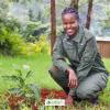
Hi! I am Frida Ruiz, a current Mechanical Engineering undergraduate student very interested in habitat restoration & conservation. I am excited to connect with others and learn about technology applications within applied ecology & potential research opportunities
- 0 Resources
- 4 Discussions
- 13 Groups
World Wide Fund for Nature/ World Wildlife Fund (WWF)

- 0 Resources
- 12 Discussions
- 15 Groups

Technologist, birder, photographer and mountain guide.
- 0 Resources
- 0 Discussions
- 18 Groups
- @vandita_shukla
- | she/her
PhD candidate studying drone flight planning for enabling tracking and identification of individual characteristics of wildlife; member of the WildDrone, an MSCA Doctoral Network funded by the European Union’s Horizon Europe research
- 0 Resources
- 0 Discussions
- 20 Groups
- @beter22
- | he
A Nigerian business journalist
- 0 Resources
- 0 Discussions
- 3 Groups
Careers
Conservation Data Coordinator

Giraffe Conservation Foundation
Giraffe Conservation Foundation has now opened this opportunity to qualified candidates willing to work remotely. The position is desktop-based and the successful candidate can work from anywhere in the world to provide...
15 July 2022
Careers
In this role, you will serve as the main data liaison for the USAID Forest Data Partnership project, integrating with Global Forest Watch and Land & Carbon Lab research teams.
14 July 2022
Careers
Service Designer

Catherine Greene
Love design, passionate about conversation? Want to make sure that technologies that are being developed actually meet the needs of the people who use them? Come and work for us!
13 July 2022
Careers
WHOI is establishing an Imaging Technology Laboratory (ITL) & seeks a senior technical leader to lead the initiative. The primary goal of the ITL is to create a center of excellence to serve the technical imaging...
11 July 2022
Careers
The NCEAS invites applications for a temporary Data Fellow to engage in data science projects relating to environmental science in deserts of California. These projects will include assisting in the organization &...
9 July 2022
Careers
Postdoc: Environmental Remote Sensing

Carly Batist
Professor Nathalie Seddon, Professor Yadvinder Malhi (University of Oxford)
30 June 2022
Careers
Applications are invited for a Research Associate to join Dr Emily Lines' UKRI Future Leaders Fellowship (FLF) project "Next generation forest dynamics modelling using remote sensing data" (University of Cambridge)....
30 June 2022
Careers
Tammy Robinson-Smythe, Stellenbosch University
30 June 2022
Careers
Research Associate in Data Fusion for Forest Monitoring and Modelling

Stephanie O'Donnell
Applications are invited for a Research Associate to join Dr Emily Lines' UKRI Future Leaders Fellowship (FLF) project "Next generation forest dynamics modelling using remote sensing data". This is an interdisciplinary...
15 June 2022
Article

This study presents a comprehensive comparison of point clouds from four systems, linear and Geiger-mode LiDAR from manned aircraft and multi-beam LiDAR on unmanned aerial vehicle (UAV), and in-house developed Backpack...
13 June 2022
Article
New remote sensing papers/datasets
Carly Batist
Near real-time global 10 m land cover mapping via Dynamic World; combining Sentinel-1 & -2 data for tree species classification; detecting elephants from drone imagery; Ecuador's satellite monitoring for illegal...
13 June 2022
Article
Julia Martínez Pardo et al., Published in Biological Conservation
4 June 2022
June 2024
event

Cassie Anderson
July 2024

September 2024

December 2023

event
Lucas Mwaura
112 Products
Recently updated products
| Description | Activity | Replies | Groups | Updated |
|---|---|---|---|---|
| Unfortunately I may fail to deliver so I cannot take it up. Am off net at times for two weeks straight. But excited about everything GIS so I follow keenly. Thank you... |
|
Remote Sensing & GIS | 4 days 13 hours ago | |
| Depending what you want to do, there are free services to annotate values for each point, interpolating between available time-location records in the RS data.The EnvDATA Track... |
|
Remote Sensing & GIS | 2 weeks 4 days ago | |
| Hi folks!@Chelsea_Smith from Fauna & Flora joined last month's variety hour to share more about Fauna & Flora's work with... |
|
Remote Sensing & GIS, Data management and processing tools, Protected Area Management Tools | 1 month 2 weeks ago | |
| Calling practitioners working in connectivity... we're doing some thinking around modelling functional connectivity, and the data that... |
|
Remote Sensing & GIS | 1 month 3 weeks ago | |
| Thank you Carly, I will definitely take a look. |
|
Acoustics, Biologging, Climate Change, Conservation Tech Training and Education, Data management and processing tools, Remote Sensing & GIS, Software and Mobile Apps | 2 months 2 weeks ago | |
| We will be conducting in-person demos of our cutting-edge drone technology in the US this year! 🇺🇸 If you're interested in experiencing... |
|
Biologging, Drones, Remote Sensing & GIS, Software and Mobile Apps | 3 months 3 weeks ago | |
| Am working on similar AI challenge at the moment. Hoping to translate my workflow to wolves in future if needed. We all are little overstretched but it there is no pressing... |
|
Camera Traps, AI for Conservation, Build Your Own Data Logger Community, Data management and processing tools, Marine Conservation, Protected Area Management Tools, Remote Sensing & GIS | 4 months 1 week ago | |
| Real nice video. I'll have another look in the weekend in detail. |
+10
|
Acoustics, Community Base, Protected Area Management Tools, Remote Sensing & GIS, Sensors | 4 months 1 week ago | |
| Hi!I would take a look at Although developed for camera trap imagery, it is by no means restricted to such.Cheers,Lars |
|
Camera Traps, Community Base, Data management and processing tools, Drones, Emerging Tech, Remote Sensing & GIS, Software and Mobile Apps | 4 months 1 week ago | |
| Thank you for the links. As a trainer in GIS I have gone through them and they are very helpful for a beginner in QGIS. |
|
Remote Sensing & GIS | 4 months 2 weeks ago | |
| Thank you for this! Will take a look. |
|
Climate Change, Conservation Tech Training and Education, East Africa Community, Remote Sensing & GIS | 4 months 3 weeks ago | |
| Appreciate that Lars! |
+20
|
Biologging, Remote Sensing & GIS | 5 months ago |


The force is strong with space lasers helping researchers map the Amazon in 3D

2 December 2022 1:16am
The International Space Station's GEDI instrument uses lasers to gather data on deforestation and impacts on atmospheric concentrations of carbon dioxide to highlight key areas to conserve.
Tech and Biodiversity Conference, London
15 November 2022 2:07pm
Spatial Data Analysis, TNC
 The Nature Conservancy
8 November 2022 11:34am
New paper: Integrating machine learning, remote sensing and citizen science to create an early warning system for biodiversity

7 November 2022 7:10pm
Opinion paper describing "how data acquired from remote sensing, citizen science & other monitoring approaches could feed in near-real time to an early warning system for biodiversity that integrates automated red-listing of species with the identification of priority areas for conservation."
Tech to Track: Harnessing thepotential of spatial data & digital technologies to prioritise nature and climate action

28 October 2022 10:14am
New conservation tech articles from Mongabay
20 October 2022 7:45pm
Conservation Technology Intern (Vietnam)
 Meredith S. Palmer
19 October 2022 9:22am
GIS & Data Science Specialist, Island Conservation
14 October 2022 12:02am
Cloud-Based Remote Sensing with Google Earth Engine

12 October 2022 9:21am
Comprehensive resource for Google Earth Engine - this ebook is an excellent source of fundamentals lessons and applications ranging from terrestrial to aquatic. It comes with a fully equipped code repo, explainers, and homework to test your skills for beginners and experts alike.
Senior GIS Officer - GIS Engineer

11 October 2022 12:14pm
GIS Officer
11 October 2022 11:32am
Frontiers Symposium: Digital tools for reversing environmental degradation
5 October 2022 10:23am
Multi-day workshop: Machine Learning Advances for Marine Acoustics & Imagery Data
4 October 2022 5:20pm
Conservation Tech Directory - new update!
29 August 2022 2:38pm
26 September 2022 10:07pm
Thanks so much!!
The planet matters. People matter. Location matters.
23 September 2022 12:16pm
Movement Ecology Field Team and Data Coordinator: Osa Conservation [Open until filled)

22 September 2022 11:55pm
Workshop: Building UK Partnerships for Conservation Technology
22 September 2022 3:02pm
Catch Up with the Variety Hour: October 2022
22 September 2022 1:59pm
Collecting Critically Endangered Plants on Cliffs using a Drone

16 September 2022 7:49pm
4th Carbon from Space Workshop: Characterising the land component of the Carbon Cycle and its connection with the ocean and atmosphere
2 September 2022 7:35pm
Postdoc: Interpretable ML for species-based image classification
1 September 2022 9:34pm
Solicitation of Interest: NAVFAC Atlantic Marine Resources

31 August 2022 7:28pm
Survey for Doctoral Research on Poaching in Protected Areas
29 August 2022 10:43pm
WWF student assistant wanted: forest impact monitoring with Earth Observation

29 August 2022 4:41pm
Conservation Technology Research Internship

26 August 2022 4:58pm
Research Scientist - NASA Ames Earth Science Division
25 August 2022 2:25pm
RCMRD Map Competition 2022

19 August 2022 1:54pm
A vegetation carbon isoscape for Australia | TERN Australia
19 August 2022 12:40pm
TERN Australia has launched a new set of open-access data products that will advance research in a range of subjects, including food chain dynamics, animal migration, carbon fluxes, and plant productivity 🌿🦘
Research Technician - Unoccupied Aircraft Systems Pilot and Geospatial Analyst
10 August 2022 10:40pm
3yr Postdoctoral Associate: Remote Sensing and Unoccupied Aircraft Systems
10 August 2022 5:29pm
23 September 2022 5:26pm
Congrats on the milestone Carly and Gracie!